place

Guston, Kent

Civil parishes in KentDover DistrictVillages in Kent
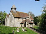
Ember Cottage and The Chance Inn, Guston geograph.org.uk 426455

Guston is a village and civil parish in the Dover district of Kent, in South East England. The village lies about a quarter of a mile north of the campus of the Duke of York's Royal Military School, near Martin Mill. In the 1950s the village was the site of a public house, a post office, a Saxon church and approximately one-hundred homes. There is also a windmill present, which has been converted into a house. Nearby villages include Whitfield, East Langdon, Pineham and Buckland. The River Dour is approximately 2.71 km away from Guston, and there is easy access to main roads, with the A2 and A258 running around and through the village. In the early 1870s, Guston was described by John Wilson: "A parish in Dover district, Kent; 2½ miles E by N of Ewell r. station, and 2½ N of Dover. Posttown, Dover. Acres, 1, 421; of which 20 are water. Real property, £2, 554. Pop., 436. Houses, 88. The property is divided among a few. The living is a vicarage in the diocese of Canterbury; and was annexed in 1868 to the vicarage of River. The church is Norman; has three windows at the west end; and is good. There is a Wesleyan chapel."

Excerpt from the Wikipedia article Guston, Kent (License: CC BY-SA 3.0, Authors, Images).

Guston, Kent
Barntye Close,

Geographical coordinates (GPS) Address Nearby Places
placeShow on map

Wikipedia: Guston, KentContinue reading on Wikipedia

Geographical coordinates (GPS)

Latitude Longitude
N 51.154 ° E 1.32 °
placeShow on map

Address

Barntye Close

Barntye Close
CT15 5ND
England, United Kingdom
mapOpen on Google Maps

Ember Cottage and The Chance Inn, Guston geograph.org.uk 426455
Share experience

Nearby Places

Fort Burgoyne
Fort Burgoyne

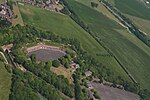
Fort Burgoyne, originally known as Castle Hill Fort, was built in the 1860s as one of the Palmerston forts around Dover in southeast England. It was built to a polygonal system with detached eastern and western redoubts, to guard the high ground northeast of the strategic port of Dover, just north of Dover Castle. The fort is named after the 19th century Field Marshal Sir John Fox Burgoyne, Inspector-General of Fortifications and son of the John Burgoyne who fought in the American Revolutionary War. After the First World War Fort Burgoyne was used as a military depot or store for Connaught Barracks. Until recently the central part of the fort was still owned by the Ministry of Defence, forming part of the Connaught Barracks site, which is now being redeveloped for housing.In 2014, Fort Burgoyne and a total of 42 Hectares of land was acquired by the Land Trust. Since acquiring the site the Trust has spent over £2.5 million on priority works (informed by a Coastal Revival Fund grant aided condition survey) to stabilise the site together with transforming the West Wing Battery of the site from condition of derelict buildings and structures lost in woodland to an informal recreation space for the community opened in 2023. As part of the Trust's long term aspiration to see the Fort become a vibrant business and community space in 2023 a project was completed providing opportunities for businesses to become the first tenants on site.