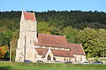
Lydbrook
Forest of DeanUse British English from February 2012Villages in Gloucestershire

Lydbrook is a civil parish in the Forest of Dean, a local government district in the English county of Gloucestershire and is located in the Wye Valley. It is on the north west edge of the Forest of Dean's present legal boundary proper. It comprises the districts of Lower Lydbrook, Upper Lydbrook, Joys Green and Worrall Hill. It has a mile and a half long high street, reputed to be the longest high street of any village in England.
Excerpt from the Wikipedia article Lydbrook (License: CC BY-SA 3.0, Authors, Images).Lydbrook
B4234, Forest of Dean Lydbrook
Geographical coordinates (GPS) Address Nearby Places Show on map
Geographical coordinates (GPS)
| Latitude | Longitude |
|---|---|
| N 51.84 ° | E -2.58 ° |
Address
B4234
GL17 9LQ Forest of Dean, Lydbrook
England, United Kingdom
Open on Google Maps


