place

Norbeck, Maryland

Montgomery County, Maryland geography stubsPopulated places in Montgomery County, MarylandUse mdy dates from June 2022Washington metropolitan area

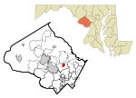
Norbeck is the area of Montgomery County, Maryland, United States, around Norbeck Road (Maryland Route 28) east of Georgia Avenue to Layhill Road. Shortly before the Civil War, free blacks founded Norbeck.

Excerpt from the Wikipedia article Norbeck, Maryland (License: CC BY-SA 3.0, Authors).

Norbeck, Maryland
Georgia Avenue,

Geographical coordinates (GPS) Address Nearby Places
placeShow on map

Wikipedia: Norbeck, MarylandContinue reading on Wikipedia

Geographical coordinates (GPS)

Latitude Longitude
N 39.11 ° E -77.075833333333 °
placeShow on map

Address

Georgia Avenue 15507
20906
Maryland, United States
mapOpen on Google Maps

Share experience

Nearby Places

Oak Lea

Oak Lea is a private home of 19th-century origin in the Layhill community of Montgomery County, Maryland, described as "the gracious culmination of architectural and building efforts dating back well over a hundred years."The house is composed of three adjoined blocks built at different times: The north block is a one-and-one-half story clapboarded log structure, which appears to be the oldest part of the house. It has a three-bay façade, obscured by an enclosed lean-to porch, with three-over-six double-hung sash windows and a boxed cornice. A chimney at the south end of the block was enclosed by construction of the central block. The central block is two stories, with a three-bay façade, and six-over-six double-hung sash windows. The south block, also of two stories, has a five-bay galleried porch, with the fifth bay enclosed as the main doorway, contiguous with the galleried porch, and a two-story chimney of modern construction at its south end.A log smokehouse and a frame bank-barn with a stone foundation were originally located to the west of the house, dating from the property's original agricultural use.Additions of three log rooms were the only major changes made in the structure until the house was renovated in 1940.In 1945, the farm's 20th century outbuildings and its pasture land were developed as a country club and golf course, Argyle Country Club, the barn becoming the club house with the hayloft repurposed for locker rooms, the milking shed as office space, and the stanchion area as the main lounge. In 1985, the remainder of the Oak Lea property was developed as Argyle Village, a 90 home subdivision adjacent to Argyle Country Club, with Oak Lea as the centerpiece.In the early mid-20th century, Oak Lea was the home of noted Maryland golfer Roland MacKenzie.Oak Lea was nominated for the National Register of Historic Places in 1974.

Lake Bernard Frank
Lake Bernard Frank

Lake Bernard Frank (also Lake Frank), is a 54-acre (220,000 m2) reservoir on the North Branch of Rock Creek in Derwood, Maryland, U.S., just east of Rockville. In the late 1960s it was renamed after Bernard Frank, a wilderness activist and a co-founder of The Wilderness Society. The lake's boundaries are, approximately, Route 28, East Gude Drive, Avery Road, and Muncaster Mill Road. Lake Frank was created in 1966 as Lake Norbeck to aid in flood and sediment control, as well as to provide recreation. It has an earthen dam, installed in 1967, on its southern side. It was created as a sister lake to Lake Needwood. Lake Frank is owned by the Maryland-National Capital Park and Planning Commission (M–NCPPC). The lake's secluded location within Rock Creek Regional Park is another of its assets. Visitors to the lake must bike or walk about 1/4 of a mile from all parking lots to get to the lakeshore. The Lake Frank & Meadowside Trails surround the lake, making it a favorite hiking spot. Also, locals enjoy fishing from the shoreline, though a license is needed to do so. However, swimming, boating, and ice skating are prohibited.The main trail around Lake Frank, the Lakeside Trail, is a 31⁄4 mile long loop. Approximately 2/3 of the trail is unpaved and traverses the woods surrounding the lake. The other part of the trail is wider and paved. At the approximate half-way point of the trail, there is a creek that must be crossed. Though there are a group of rocks which form a bridge-like path across, the creek may be impassable depending on the water level.