place

Rockaway Freeway

New York City road stubsStreets in Queens, New YorkTransportation in Rockaway, Queens
Bch 108th St Rkwy Freeway td 06

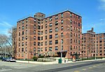
The Rockaway Freeway is a road in the New York City borough of Queens that was created from the old right-of-way of the Long Island Rail Road Rockaway Division in 1941–1942 as part of the project to eliminate grade crossings within New York City. The railroad line itself was elevated over the new automotive route, and was incorporated into the New York City Subway system as the IND Rockaway Line (A train) in June 1956.Because of the large number of concrete posts supporting the elevated subway, the Freeway has consistently been hazardous for drivers; at least one driver died from crashing into a pillar. A portion of the road, between Beach 67th Street and Beach 73rd Street, was closed permanently in 2009 to make way for a retail transit plaza in connection with the new Arverne-by-the-Sea construction development.

Excerpt from the Wikipedia article Rockaway Freeway (License: CC BY-SA 3.0, Authors, Images).

Rockaway Freeway
Rockaway Freeway, New York Queens

Geographical coordinates (GPS) Address External links Nearby Places
placeShow on map

Wikipedia: Rockaway FreewayContinue reading on Wikipedia

Geographical coordinates (GPS)

Latitude Longitude
N 40.591894444444 ° E -73.792269444444 °
placeShow on map

Address

Rockaway Freeway

Rockaway Freeway
12692 New York, Queens
New York, United States
mapOpen on Google Maps

linkWikiData (Q7354952)
linkOpenStreetMap (558640219)

Bch 108th St Rkwy Freeway td 06
Share experience

Nearby Places

Kohlreiter Square
Kohlreiter Square

Kohlreiter Square is an 8.6-acre public green space located in the Arverne neighborhood on Rockaway Peninsula in Queens, New York. It located along the north side of Rockaway Freeway between Beach 67th and Beach 69th Streets. The park honors two generations of civic activists, Nathan A. Kohlreiter (1880–1961) and his son Fred Kohlreiter (1913–1990) who contributed to the political and social fabric of the neighborhood. Kohlreiter Square dates to the early twentieth century, when it served as a plaza to the Arverne – Gaston Avenue Long Island Railroad (LIRR) station. The station opened in 1887, shortly before the completion of Arverne-By-The-Sea, a community of upscale summer homes and hotels along the beach. The neighborhood’s name is an abbreviation of its developer’s name, Remington R. Vernam. The tracks were elevated in 1942, with the Rockaway Freeway running beneath them. As part of a grade elimination project, undeveloped and condemned properties along the Freeway were acquired by the city as parkland. The station plaza was acquired from the LIRR in 1946. In 2001 construction commenced on a new residential community that revived the name Arverne-by-the-Sea. Comprising single and multi-family homes to the south of Rockaway Freeway, it includes a retail plaza on the southern side of the subway station, adjoining Kohlreiter Square. Before 2001, there was a Joseph P. Addabbo Family Health Center on the southern side of the 67th street subway station, and a synagogue across the street from the health center. The synagogue burned down in 2001, and the family health center moved to a new building on Beach 62nd street after it was built in 2005. The old building was torn down in 2006 during the construction of the retail plaza.

Rockaway Beach and Boardwalk

The Rockaway Beach and Boardwalk is a public park in Rockaway, Queens, New York, composed of the 170-acre (69 ha) Rockaway Beach and the adjacent 5.5-mile (8.9 km) Rockaway Boardwalk, which is also the longest boardwalk in the US. The beach runs from Beach 9th Street in Far Rockaway to Beach 149th Street in Neponsit, a distance of 7 miles (11 km). The boardwalk, a concrete deck, runs from Beach 9th Street to Beach 126th Street in Rockaway Park, at the edge of Belle Harbor. There are also numerous recreational facilities within the park, parallel to the beach and boardwalk. The beach became a popular resort area in the late 19th century, and several disconnected sections of the boardwalk were constructed by the end of the century. The first section of city-owned boardwalk between Beach 109th and 126th Street was completed in 1923, and the city announced plans for a massive boardwalk two years later, stretching across most of the Rockaway peninsula's southern shore. The city government completed the sections between Beach 19th and 109th Streets in three phases between 1928 and 1930. The concrete boardwalk from Beach 9th Street to Beach 19th Street was completed in 1963. After Hurricane Sandy destroyed much of the boardwalk in 2012, it was rebuilt in several phases through 2017. The park has been maintained by the New York City Department of Parks and Recreation since 1938. It is policed by the New York City Parks Enforcement Patrol.

Edgemere Landfill
Edgemere Landfill

Edgemere Landfill is a former municipal landfill located in Edgemere on the Rockaway peninsula in Queens, New York City. It is located on a man-made peninsula on the Jamaica Bay shoreline, at the eastern end of the Rockaway peninsula. A portion of the site is currently open to the public as Rockaway Community Park (formerly Edgemere Park). The entire site is owned by the New York City Department of Parks and Recreation. The landfill began operations in June 1938, merging several islands in the Jamaica Bay marshland and connecting them to the main Rockaway Peninsula. Shortly afterward, a portion of the site was used as the Rockaway Airport. Edgemere Park was conceived for the landfill site in the 1950s by New York City Parks Commissioner Robert Moses, as part of the infrastructure for the adjacent Edgemere Houses housing project. The site, along with several other planned parks in the city, continued operations as a landfill in order to fill the marshland for park development. The small portion of Rockaway Community Park adjacent to the Edgemere Houses was developed in the 1960s. During its operation, the landfill was a dumping site for toxic chemicals and waste oil, and served as a hazard to nearby John F. Kennedy International Airport by attracting birds. Following the discovery of toxic waste drums in the landfill in 1983, the landfill was declared a Superfund site. It was closed in 1991 and capped afterwards. The peak of the landfill is the tallest point in the Rockaways, measuring 70 feet (21 m) high.: 5  The landfill is claimed to be "the longest continuously operating dump in the United States", accepting waste from 1938 to 1991.: 50  It is also one of the oldest landfills in New York City, and was the second-to-last city landfill to remain in operation. The final landfill, Fresh Kills Landfill in Staten Island, closed in 2001.