Marton-le-Moor

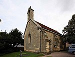
Marton-le-Moor is a village and civil parish in the Harrogate district of North Yorkshire, England. It is very near the A1(M) motorway, 4 miles (6.4 km) east of Ripon and 3 miles (4.8 km) west of Boroughbridge. The name of the village derives from a mixture of Latin, Old English and Old Norse; Marr tūn super mōr, which means marsh farm (or settlement) on the moor. According to the 2001 UK census, Marton-le-Moor parish had a population of 174, increasing to 182 in the 2011 Census. In 2015, North Yorkshire County Council estimated the population of the village to be 190. Village affairs are conducted by the Parish Council. Social functions are held regularly and organised by the Village Meeting Room committee which converted the Blacksmith shop to be used as a local community hall. The grade II listed St Mary's church, which was built in 1830, is now no longer in regular use for worship, having been declared redundant in 2004. During 2009, it was offered for sale without any mains electric or water connection, and a promise made by the buyer "not to disturb any human remains in the grounds". The Parish Council is going to turn the unused part of St Mary's churchyard into a community garden to benefit all sectors of the community, especially older people and mothers with toddlers.
Excerpt from the Wikipedia article Marton-le-Moor (License: CC BY-SA 3.0, Authors, Images).Marton-le-Moor
Whitegate Lane,
Geographical coordinates (GPS) Address Nearby Places Show on map
Geographical coordinates (GPS)
| Latitude | Longitude |
|---|---|
| N 54.12989 ° | E -1.43383 ° |
Address
Whitegate Lane
Whitegate Lane
HG4 5AT , Marton-le-Moor
England, United Kingdom
Open on Google Maps


