Splott

Splott (Welsh: Y Sblot) is a district and community in the south of the city of Cardiff, capital of Wales, just east of the city centre. It was built up in the late 19th century on the land of two farms of the same name: Upper Splott and Lower Splott Farms. Splott is characterised by its once vast steelworks and rows of tightly knit terraced houses. The suburb of Splott falls into the Splott electoral ward. Fanciful suggestions for the origin of the name have included a truncation of "God's Plot", as the land belonged to the Bishop of Llandaff in medieval times, and a derivation of plat, meaning a grassy area of land. The name of the original farm would seem to be Middle English "splott", from Old English (speck, blot, patch of land) and the word is to be found in other English place names in the Vale of Glamorgan, Gower, and Pembrokeshire, as well as in Somerset and Devon, in the West Country of England, from where it was presumably introduced by English settlers. It has frequently been noted on lists of unusual place names.The population of Splott in the United Kingdom Census 2001 was 12,074, in 5,101 households, of which only 183 are detached homes. Of the 8,221 adults in the area, only 1,000 have the lowest category of qualifications (Level 1 or below). In 2011 the population had increased to 13,261.
Excerpt from the Wikipedia article Splott (License: CC BY-SA 3.0, Authors, Images).Splott
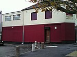
Splott Road, Cardiff Splott
Geographical coordinates (GPS) Address Nearby Places Show on map
Geographical coordinates (GPS)
| Latitude | Longitude |
|---|---|
| N 51.48357 ° | E -3.15349 ° |
Address
Splott Road
CF24 2BZ Cardiff, Splott
Wales, United Kingdom
Open on Google Maps


