place

Old Oscott

Areas of Birmingham, West MidlandsGreat BarrHistory of StaffordshireKingstandingWest Midlands (county) geography stubs

Old Oscott (originally Oscott) is an area of Great Barr, Birmingham, England (previously in the parish of Handsworth, Staffordshire). The suburb forms a triangle bounded to the north by Pheasey, to the west by Perry Beeches, and to the east by Kingstanding. The Birmingham City Council ward that covers the area is called simply Oscott. The area has been known locally as "Old" Oscott since St. Mary's College, the Roman Catholic seminary, moved to a new site in an area that became known as New Oscott. The area was mostly developed between 1920 and 1960, with a mix of both private and council housing. Old Oscott F.C. takes its name from the area.

Excerpt from the Wikipedia article Old Oscott (License: CC BY-SA 3.0, Authors).

Old Oscott
Oscott School Lane, Birmingham

Geographical coordinates (GPS) Address Nearby Places
placeShow on map

Wikipedia: Old OscottContinue reading on Wikipedia

Geographical coordinates (GPS)

Latitude Longitude
N 52.54696 ° E -1.89355 °
placeShow on map

Address

Oscott School Lane

Oscott School Lane
B44 9AE Birmingham
England, United Kingdom
mapOpen on Google Maps

Share experience

Nearby Places

Queslett
Queslett

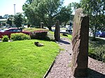
Queslett is an area of Great Barr, Birmingham, England. The name (originally Quieslade) has been in use since the 16th century. The first part, from "Queest", means a wood pigeon, the second comes from the Anglo-Saxon "slade", for a small valley. Another old spelling, Queeslet, appears on Victorian maps and postcards. The area was part of Staffordshire until 1928. In 1810, in A Complete History of the Druids, T G Lomax described the area: At the declivity of very pleasingly diversified hills, near Quieslade, is a most delightful lake, by crossing the head of which, the admirer of variegated landscape will be amply rewarded by an agreeable range over the opposite hills, where the High-Wood and Barr Beacon present themselves to view; and by gradually climbing the first of these two summits, the south-east prospect becomes very rich and extensive; and the latter presents an unbounded panorama into fifteen counties, which PLOT, in his History of Staffordshire, has specified. (the later being a reference to Robert Plot's Natural History of Staffordshire). The area was mostly developed with private housing from the 1930s onwards, and is centred on the A4041 Queslett Road between West Bromwich and Sutton Coldfield, overlooked by Barr Beacon. A former sand quarry, on the site of William Booth's farm, was subsequently used for landfill. One half of the site is now Queslett Nature Reserve. The Moonstones, an artwork commemorating The Lunar Society, who met at nearby Great Barr Hall, stands in the grounds of a supermarket, on the site of the quarry's former office.

Perry Beeches

Perry Beeches is an area of Great Barr, Birmingham, England, within the parliamentary constituency of Perry Barr. Previously agricultural, with some sand and gravel quarrying on the site of Asda Queslett; it was developed as a residential suburb of Birmingham immediately before and after World War II. Many of the houses in the Thornbridge Avenue and Booth's Farm Road areas were constructed before the outbreak of war, while the remaining part of the estate (between the Beeches and Aldridge Roads) was completed after 1945. The Perry Beeches area is bisected by the M6 motorway, constructed in the early 1970s. The housing in the southern part of Perry Beeches -in the Thornbridge Avenue area and at the eastern end of the Beeches Road (formerly known as Brick Kiln Lane)- was built by Henry Boot of Sheffield for the 'First National Housing Trust' - who also built a similar estate, albeit with houses of a slightly larger floorplan, at Pheasey. This is located to the north-east of the Beeches Estate on land that was part of Aldridge Urban District Council and now part of Walsall Metropolitan Borough Council. Most of these houses were built in blocks of 4-6 with some blocks of 2 semi-detached in a similar style where space would not allow for larger blocks, or where the land was too steep for these blocks - notably in Holmesfield Road; that was built on a steep hill. While many residents have now bought these properties and made many alterations, the original floorplan for most houses consisted of a hallway, front room and then a rear kitchen with pantry, coal hole and a downstairs toilet. As these houses were originally rented, they had identical wooden doors and windows painted cream, with either dark green or brown doors and outer frames. Wooden fences with a garden hedge were also placed around every house. The houses to the north of the area (north of the Beeches Road between the Walsall and M6) were by contrast privately owned. These are mostly blocks of semi-detached houses with generally more decorative features, including large circular bay windows on the upper and ground floor, stained glass front doors and windows, and in most cases both a front and back reception room. At the rear of most houses in the Walsall Road and Booths Farm Road area, the houses were built with long rear access 'right of ways'. These proved useful as more people owned a private car from the early 1950s onwards and were able to build a garage on the bottom part of their back garden plot opening onto these 'right of ways'. They also made good short-cuts. In recent years, however, these became good access routes for thieves breaking into garages and houses. Due to this, many now have large padlocked gates at their roadside entrance and are only accessible to residents. There are a number of primary schools around this area and two secondary schools with one being directly located on the Beeches Estate. Secondary education is provided at Arena Academy.