place

Weverton, Maryland

Unincorporated communities in MarylandUnincorporated communities in Washington County, Maryland

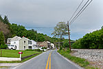
Weverton is an unincorporated community hamlet located in the southern tip of Washington County, Maryland, United States, near the north shore of the Potomac River. Its population is about 500. Weverton is located at the intersection of MD Route 67 and U.S. Route 340. The nearest incorporated communities are Harpers Ferry, West Virginia (1.5 miles (2.4 km) to the west) and Brunswick ( 2.7 miles (4.3 km) to the east). Weverton's approximate elevation is 475 feet (145 m) above sea level. Weverton Cliffs, at the southern end of South Mountain where that ridge is interrupted by the Potomac River, are a landmark on the Appalachian Trail; they sit nearly at the halfway point of the trail and are well-known to through hikers. Weverton is the northwestern end of CSX Transportation's Metropolitan Subdivision, a 79-mile rail line that runs to Washington, D.C.

Excerpt from the Wikipedia article Weverton, Maryland (License: CC BY-SA 3.0, Authors).

Weverton, Maryland
Appalachian National Scenic Trail,

Geographical coordinates (GPS) Address Nearby Places
placeShow on map

Wikipedia: Weverton, MarylandContinue reading on Wikipedia

Geographical coordinates (GPS)

Latitude Longitude
N 39.332777777778 ° E -77.681666666667 °
placeShow on map

Address

Appalachian National Scenic Trail

Appalachian National Scenic Trail
21715
Maryland, United States
mapOpen on Google Maps

Share experience

Nearby Places

Harpers Ferry National Historical Park

Harpers Ferry National Historical Park, originally Harpers Ferry National Monument, is located at the confluence of the Potomac and Shenandoah rivers in and around Harpers Ferry, West Virginia. The park includes the historic center of Harpers Ferry, notable as a key 19th-century industrial area and as the scene of John Brown's failed abolitionist uprising. It contains the most visited historic site in the state of West Virginia, John Brown's Fort.The park includes land in the Shenandoah Valley in Jefferson County, West Virginia; Washington County, Maryland and Loudoun County, Virginia. The park is managed by the National Park Service, an agency of the U.S. Department of the Interior. Originally designated Harpers Ferry National Monument in 1944, the park was declared a National Historical Park by the U.S. Congress in 1963. Consisting of almost 4,000 acres (16 km2), it includes the site of which Thomas Jefferson once wrote, "The passage of the Potomac through the Blue Ridge is perhaps one of the most stupendous scenes in Nature" after visiting the area in 1783. Due to a mixture of historical events and ample recreational opportunities, all within 50 miles (80 km) of Washington, D.C., the park was listed on the National Register of Historic Places on October 15, 1966. In 2017, the Park's Superintendent was Tyrone Brandyburg.The park was originally planned as a memorial to John Brown, responsible for what is by far the most famous incident in Harpers Ferry's history, his 1859 raid and capture of the federal armory. NPS officials in the 1930s focused on John Brown's raid and the Civil War to justify acquiring parts of Harpers Ferry for a historical and military park. Like the figure of John Brown himself, this proved enormously controversial, with opposition from white supremacist organizations such as the United Daughters of the Confederacy and the Sons of Confederate Veterans.: 86