place

Luzerne County Community College

1967 establishments in PennsylvaniaCommunity colleges in PennsylvaniaNortheastern United States university stubsPennsylvania school stubsTwo-year colleges in the United States
Universities and colleges established in 1967Universities and colleges in Luzerne County, Pennsylvania

Luzerne County Community College (LCCC) is a public community college in Nanticoke, Pennsylvania. LCCC offers over 100 academic, technical, and career programs. The institution uses an open admissions policy for most programs, and has over 35,000 graduates. In addition to the 167-acre main campus in Nanticoke, the school maintains 7 satellite learning centers located throughout Northeastern Pennsylvania. LCCC Dedicated Centers are located in Berwick, Wilkes-Barre, Scranton, Shamokin, Hazleton, Pittston, and Watsontown. The college is accredited by the Middle States Commission on Higher Education. It offers 71 occupational programs (includes degree, certificate, and diploma programs), 25 liberal arts/transfer programs, 10 credit-free career training programs as well as numerous conferences, seminars, workshops, and business/industry customized training either on-campus or throughout the community During the fall 2019 semester approximately 9,000 students were enrolled in credit and noncredit courses. The student to faculty ratio is 18:1.

Excerpt from the Wikipedia article Luzerne County Community College (License: CC BY-SA 3.0, Authors).

Luzerne County Community College
South Prospect Street,

Geographical coordinates (GPS) Address External links Nearby Places
placeShow on map

Wikipedia: Luzerne County Community CollegeContinue reading on Wikipedia

Geographical coordinates (GPS)

Latitude Longitude
N 41.193 ° E -75.993 °
placeShow on map

Address

Luzerne County Community College

South Prospect Street 1333
18634
Pennsylvania, United States
mapOpen on Google Maps

linkWikiData (Q6706571)
linkOpenStreetMap (497055981)

Share experience

Nearby Places

Luzerne County, Pennsylvania

Luzerne County is a county in the Commonwealth of Pennsylvania. According to the United States Census Bureau, the county has a total area of 906 square miles (2,350 km2), of which 890 square miles (2,300 km2) is land and 16 square miles (41 km2) is water. It is Northeastern Pennsylvania's second-largest county by total area. As of the 2020 census, the population was 325,594, making it the most populous county in the northeastern part of the state. The county seat and largest city is Wilkes-Barre. Other populous communities include Hazleton, Kingston, Nanticoke, and Pittston. Luzerne County is included in the Scranton–Wilkes-Barre–Hazleton Metropolitan Statistical Area, which has a total population of 555,426 as of 2017. On September 25, 1786, Luzerne County was formed from part of Northumberland County. It was named after Chevalier de la Luzerne, a French soldier and diplomat during the 18th century. When it was founded, Luzerne County occupied a large portion of Northeastern Pennsylvania. From 1810 to 1878, it was divided into several smaller counties. The counties of Bradford, Lackawanna, Susquehanna, and Wyoming were all formed from parts of Luzerne County.The county gained prominence in the 19th and 20th centuries as an active anthracite coal mining region, drawing a large portion of its labor force from European immigrants. At its peak (in 1930), the county's population was 445,109. Many factories and coal mines closed by the early 21st century. Like most regions in the Rust Belt, Luzerne County witnessed population loss and urban decay. However, in recent years, the economy has grown moderately; warehousing has replaced manufacturing as the main industry.

Nanticoke Creek
Nanticoke Creek

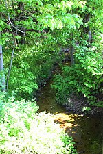
Nanticoke Creek is a tributary of the Susquehanna River in Luzerne County, Pennsylvania, in the United States. It is approximately 4.4 miles (7.1 km) long and flows through Hanover Township and Nanticoke. The watershed of the creek has an area of 7.57 square miles (19.6 km2). The creek has one named tributary, which is known as Espy Run. Nanticoke Creek impaired by pH and metals due to abandoned mine drainage. Abandoned mine drainage discharges in the creek's watershed include the Truesdale Mine Discharge and the Askam Borehole. The creek is located in the Northern Middle Anthracite Field and is in the Anthracite Valley Section of the ridge and valley physiographic province. The main rock formations in the watershed include the Mauch Chunk Formation, the Pottsville Group, and the Llewellyn Formation. The surficial geology consists of coal dumps, surface mining land, alluvium, Wisconsinan Outwash, Wisconsinan Till, urban land, and bedrock. The watershed of Nanticoke Creek is mainly forested, but urban land and mining land are also present. The city of Nanticoke is partially in the watershed and many unincorporated communities are there as well. The creek is named after the Nanticoke tribe, but was historically known as Muddy Run before appearing on maps with its present name by 1776. Extensive mining, both underground and on the surface, has been done in the creek's watershed. Numerous passive and active treatment systems have been installed in the watershed in recent times. Nanticoke Creek is designated as a Coldwater Fishery and a Migratory Fishery. However, it is relatively lacking in aquatic life.