place

Ventura County, California

1873 establishments in CaliforniaCalifornia countiesCounties in Southern CaliforniaGreater Los AngelesMajority-minority counties in California
Pages including recorded pronunciationsPopulated places established in 1873Use mdy dates from November 2023Vague or ambiguous time from January 2022Ventura County, California
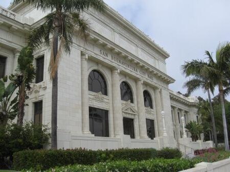
VenturaCountyCourthouse1 sm

Ventura County ( ) is a county located in the southern part of the U.S. state of California. As of the 2020 census, the population was 843,843. The largest city is Oxnard, and the county seat is the city of Ventura.Ventura County comprises the Oxnard–Thousand Oaks–Ventura, CA Metropolitan Statistical Area, which is part of the Greater Los Angeles area (Los Angeles–Long Beach, CA Combined Statistical Area). It is also considered the southernmost county along the California Central Coast.Two of the Channel Islands are part of the county: Anacapa Island, which is the most visited island in Channel Islands National Park, and San Nicolas Island.

Excerpt from the Wikipedia article Ventura County, California (License: CC BY-SA 3.0, Authors, Images).

Ventura County, California
Wheeler Canyon Road,

Geographical coordinates (GPS) Address Nearby Places
placeShow on map

Wikipedia: Ventura County, CaliforniaContinue reading on Wikipedia

Geographical coordinates (GPS)

Latitude Longitude
N 34.36 ° E -119.15 °
placeShow on map

Address

Wheeler Canyon Road

Wheeler Canyon Road

California, United States
mapOpen on Google Maps

VenturaCountyCourthouse1 sm
Share experience

Nearby Places

Oxnard Plain
Oxnard Plain

The Oxnard Plain is a large coastal plain in southwest Ventura County, California, United States surrounded by the mountains of the Transverse ranges. The cities of Oxnard, Camarillo, Port Hueneme and much of Ventura as well as the unincorporated communities of Hollywood Beach, El Rio, Saticoy, Silver Strand Beach, and Somis lie within the over 200-square-mile alluvial plain (520 km2). The population within the plain comprises a majority of the western half of the Oxnard-Thousand Oaks-Ventura Metro Area and includes the largest city along the Central Coast of California. The 16.5-mile-long coastline (26.6 km) is among the longest stretches of continuous, linear beaches in the state. The high quality soils, adequate water supply, favorable climate, long growing season, and level topography are characteristic of the Oxnard Plain where the top cash crops are strawberries, raspberries, nursery stock and celery. Ventura County is one of the principal agricultural counties in the state and it is a significant component of the economy with a total annual crop value in the county of over $1.8 billion in 2014. There is strong public sentiment for retaining agricultural production, as reflected in the SOAR (Save Open Space and Agricultural Resources) initiatives that have been approved by voters.This plain has been formed chiefly by the deposition of sediments from the Santa Clara River and Calleguas Creek. This plain contained a series of marshes, salt flats, sloughs, and lagoons prior to the expansion of agriculture. The Santa Clara River is one of the largest river systems along the coast of Southern California and only one of two remaining river systems in the region that remain in their natural states. The Oxnard Plain faces the Santa Barbara Channel portion of the Southern California Bight, extending from the abrupt transition of the steep rocky shore at Point Mugu in the Santa Monica Mountains on the south to the Ventura River on the north. Prominent on the southeastern horizon are Conejo Mountain and Boney Peak. The Oxnard Plain contains a considerable petroleum reserve with several active oil fields – the Oxnard Oil Field, east of Oxnard, the West Montalvo Oil Field, along the coast south of the outlet of the Santa Clara River, and the Santa Clara Avenue Oil Field north of U.S. Highway 101 near El Rio. There are also several smaller abandoned oil fields. Oil facilities are interspersed with agricultural land uses both east and west of Oxnard.