place

Dunsyre

All accuracy disputesSouth Lanarkshire geography stubsVillages in South Lanarkshire
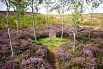
Black Mount, Dunsyre, Lanarkshire

Dunsyre (Scottish Gaelic: Dùn Saghair) is a village in South Lanarkshire, Scotland. It is 10 kilometres (6 mi) from Carnwath. Dunsyre is associated with an ancient barony and parish church. The name of Dunsyre is of Celtic origin and is supposed to signify the "Hill of the Seer." It is located by the burn known as the South Medwin Water. From 1867 until 1945 Dunsyre was served by a railway branch from Carstairs to Dolphinton, originally built by the Caledonian Railway, and the disused embankment of this runs along the south side of the village close to the church.The surface is generally elevated, and rises further still into the surrounding hills. Dunsyre Hill overlooks the area from the north and Blackmount from the south. Dunsyre Hill forms the termination of the Pentland Hills, a range extending for nearly 32 km (20 mi) from the immediate vicinity of Edinburgh. This hill has an elevation of 150 metres (500 ft) above the general surface of the lands, and of 401 metres (1,315 ft) above sea level; a small range of gradually diminishing hills branches off towards the west from it, stretching to the parish of Carnwath. Between the Dunsyre and Walston ranges is a level valley about 5 km (3 mi) in length and 1.6 km (1 mi) wide. The small river of the South Medwin runs along the valley, eventually joining the river Clyde. The ornamental garden Little Sparta lies immediately to the west of the village.

Excerpt from the Wikipedia article Dunsyre (License: CC BY-SA 3.0, Authors, Images).

Dunsyre
Newbigging Road,

Geographical coordinates (GPS) Address Nearby Places
placeShow on map

Wikipedia: DunsyreContinue reading on Wikipedia

Geographical coordinates (GPS)

Latitude Longitude
N 55.718055555556 ° E -3.4777777777778 °
placeShow on map

Address

Newbigging Road

Newbigging Road
ML11 8FL
Scotland, United Kingdom
mapOpen on Google Maps

Black Mount, Dunsyre, Lanarkshire
Share experience

Nearby Places

Skirling
Skirling

Skirling is a parish, community council area and village in Peeblesshire in the Scottish Borders situated 2+1⁄2 miles east of Biggar in Lanarkshire. Biggar Water, a tributary the River Tweed forms the southern boundary of the parish with the parish of Broughton, Glenholm and Kilbucho. It is also bounded by that parish on the east, namely the Broughton part of it. On the north it is bounded by the parish Kirkurd in Peeblesshire. Spittal Burn forms most of its western boundary with Lanarkshire. The parish lies in the Southern Uplands. Its village is 690 ft above sea level. Its length, north to south, is 3 miles and it is 2 miles at most wide. The highest point in the parish is Broomy Law, 1399 ft, on the north-west boundary. At its northernmost point the parish is met by 5 other parishes (boundary stone at site). The earliest known record of Skirling by name dates from the reign of King Robert Bruce, who granted the barony of Scrawline to John Monfode. The barony of Skirling was possessed by the Cockburn family c.1370 - 1621 and during the 18th and 19th centuries by the Carmichael family. Thomas Gibson-Carmichael was raised to peerage of the United Kingdom in 1912 as Baron Carmichael of Skirling, but this title became extinct on his death in 1926. He commissioned the building of Skirling House in 1905. The earliest record of a church is in 1275, sited near the present war memorial. Former ministers include John Greig. In 1843, William Hanna left the established Church of Scotland in 1843, joining the Free Church of Scotland, taking most of his congregation with him. The present building was rebuilt in 1720 and was much altered in 1891. It has a pleasant bell tower with a sundial, the bell dating from 1748. Ironwork on the graveyard gates is by Thomas Hadden and the Carmichael family plot is flanked by two charming angel sculptures. The church is now a member of the linked "Parishes of Upper Tweeddale", which is made up of four neighbouring Parishes.The Skirling Community Council area is the same as the civil parish. The council has 6 members.The village of Skirling has a central position in the parish. It originally consisted of five small farms on the valley floor of Skirling Burn, forming a roughly linear shaped settlement. The village is a conservation area, which includes the parish church, the old Free church, Skirling House, along with many 1 - 2 story buildings made from traditional materials. Just south-west of the village is the site of Skirling Castle, described as "ane notable beilding" and demolished and burnt by Regent Moray on 12 June 1568.The village war memorial was designed by Sir Robert Lorimer and added in 1920.The civil parish has a population of 194 (in 2011) and its area is 3,423 acres.At 11.18am on 31 December 2020 Skirling was the epicentre of a 1.9 Magnitude earthquake which was also felt in Biggar, Symington, West Linton and Peebles. Locals reported that they heard a "loud bang" or "loud rumbling noise" and that the "room shuddered".