place

Frankfurter Judengasse

1460s establishments in the Holy Roman Empire1462 establishments in Europe1796 disestablishments in the Holy Roman EmpireFrankfurt-AltstadtHistoric Jewish communities
History of FrankfurtJewish German historyJewish communities in GermanyJewish ghettos in EuropeJewish museums in GermanyJews and Judaism in FrankfurtMuseums and exhibits about antisemitismMuseums in FrankfurtReligion in Frankfurt
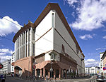
Museum judengasse ffm002

The Frankfurter Judengasse ("Jews' Lane" in German) was the Jewish ghetto of Frankfurt and one of the earliest ghettos in Germany. It existed from 1462 until 1811 and was home to Germany's largest Jewish community in early modern times. At the end of the 19th century, most of the buildings in the Judengasse were demolished. The area suffered major destruction during World War II and reconstruction left no visible signs of the ghetto in today's townscape of Frankfurt. Post-war usage of the area included a car park, a petrol station and a wholesale flower market. The decision to build an administrative complex triggered a public discussion as to what should be done with the archaeological remains uncovered during the excavation in 1977. The foundations of 19 buildings were found and five of these can be seen at the "Museum Judengasse" which was incorporated into the new building.

Excerpt from the Wikipedia article Frankfurter Judengasse (License: CC BY-SA 3.0, Authors, Images).

Frankfurter Judengasse
An der Staufenmauer, Frankfurt Altstadt (Innenstadt 1)

Geographical coordinates (GPS) Address Nearby Places
placeShow on map

Wikipedia: Frankfurter JudengasseContinue reading on Wikipedia

Geographical coordinates (GPS)

Latitude Longitude
N 50.113611111111 ° E 8.6869444444444 °
placeShow on map

Address

An der Staufenmauer 5
60311 Frankfurt, Altstadt (Innenstadt 1, Innenstadt)
Hesse, Germany
mapOpen on Google Maps

Museum judengasse ffm002
Share experience

Nearby Places

Altstadt (Frankfurt am Main)

The Altstadt (old town) is a quarter (Stadtteil) of Frankfurt am Main, Germany. It is part of the Ortsbezirk Innenstadt I. The Altstadt is located on the northern Main river bank. It is completely surrounded by the Innenstadt district, Frankfurt's present-day city centre. On the opposite side of the Main is the district of Sachsenhausen. The historic old town of Frankfurt was one of the largest half-timbered towns in Germany until the extensive destruction in World War II with its around 1250 half-timbered houses, most of which date from the Middle Ages. It was one of the most important tourist attractions for Germany. The historic old town was largely destroyed by the air raids on Frankfurt am Main in 1944. The streets and the entire district are predominantly characterized by quickly and easily erected buildings from the 1950s and 60s. A handful of the most important historic buildings, churches and squares were restored or reconstructed, especially around the main square, the Römerberg. However, from 2012 to 2018, a small section of the old town was reconstructed. A construction project known as the Dom-Römer project, restored a small section of the old town between the Imperial Cathedral and the Römer town hall, following a decision by the city council in 2007. A few former streets and squares that once stood in the area were rebuilt, most notably the historical coronation route of German emperors through the old town from the cathedral.