place

Timeline of Frankfurt

Commons category link is locally definedDynamic listsHistory of FrankfurtLists by city in GermanyTimelines of cities in Germany
Years in Germany

The following is a timeline of the history of the city of Frankfurt am Main, Germany.

Excerpt from the Wikipedia article Timeline of Frankfurt (License: CC BY-SA 3.0, Authors).

Timeline of Frankfurt
Fahrgasse, Frankfurt Altstadt (Innenstadt 1)

Geographical coordinates (GPS) Address Nearby Places
placeShow on map

Wikipedia: Timeline of FrankfurtContinue reading on Wikipedia

Geographical coordinates (GPS)

Latitude Longitude
N 50.111806 ° E 8.685944 °
placeShow on map

Address

Fahrgasse 27
60311 Frankfurt, Altstadt (Innenstadt 1, Innenstadt)
Hesse, Germany
mapOpen on Google Maps

Share experience

Nearby Places

Haus zur goldenen Waage

The Haus zur Goldenen Waage is a medieval half-timbered house in the old town of Frankfurt am Main, which was destroyed in the air raid on 22 March 1944. Because of its high architectural and historic value, it is one of the most famous sights of the city. It is situated in front of the main entrance of the cathedral on the corner of the narrow Höllgasse, which leads from the cathedral square to the Römerberg and Altstadtgasse. The detailed Renaissance facade dates from 1619. The remains of the house, which would have allowed reconstruction after the war, were eliminated in 1950. However, the archways remained preserved as part of a private library in Götzenhain. For more than 20 years the land was fallow. Then in 1972–73, during the construction of the subway station Dom / Römer, the Archaeological Garden was created, allowing access to excavations of the Roman settlement on Cathedral hill and the Carolingian Royal Palace Frankfurt. In 2007, reconstruction of parts of the former old town became part of the Dom-Römer Project, which included the rebuilding of the Goldenen Waage. Work did not start until 2014. During the reconstruction, the Archaeological Garden was covered over but remains accessible via the neighbouring townhouse on the market square. In December 2017, the half-timbered facade, the Renaissance ceiling and the belvedere were completed. There are plans to open the restored building to the public in 2019, along with a café and a local office of the Historical Museum.

Altstadt (Frankfurt am Main)

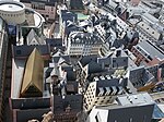
The Altstadt (old town) is a quarter (Stadtteil) of Frankfurt am Main, Germany. It is part of the Ortsbezirk Innenstadt I. The Altstadt is located on the northern Main river bank. It is completely surrounded by the Innenstadt district, Frankfurt's present-day city centre. On the opposite side of the Main is the district of Sachsenhausen. The historic old town of Frankfurt was one of the largest half-timbered towns in Germany until the extensive destruction in World War II with its around 1250 half-timbered houses, most of which date from the Middle Ages. It was one of the most important tourist attractions for Germany. The historic old town was largely destroyed by the air raids on Frankfurt am Main in 1944. The streets and the entire district are predominantly characterized by quickly and easily erected buildings from the 1950s and 60s. A handful of the most important historic buildings, churches and squares were restored or reconstructed, especially around the main square, the Römerberg. However, from 2012 to 2018, a small section of the old town was reconstructed. A construction project known as the Dom-Römer project, restored a small section of the old town between the Imperial Cathedral and the Römer town hall, following a decision by the city council in 2007. A few former streets and squares that once stood in the area were rebuilt, most notably the historical coronation route of German emperors through the old town from the cathedral.

Dom-Römer Project
Dom-Römer Project

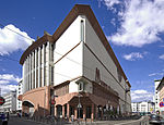
The New Frankfurt Old Town (also known as the Dom-Römer Quarter) is the centre of the old town of Frankfurt am Main, which was reconstructed from 2012 to 2018 as part of a major urban development project called the Dom-Römer Project (German: Dom-Römer-Projekt). The project redesigned and developed a 7,000 square meter property between Römerberg in the west and Domplatz in the east, delimited by Braubachstrasse in the north and the Schirn Kunsthalle in the south, in an effort to remake the old city centre, the Altstadt (old town) of Frankfurt am Main, Germany, which was severely damaged during World War II, in the style of the pre-war architecture. It aims to give the old town quarter between the Römerberg square and the Cathedral (Dom) new life. The old city had already been thoroughly changed in 1904 by hewing several aisles for wide streets into the medieval cluster of insalubrious houses and small alley ways, clearing the way for a tramway line through the historic centre. Due to the heavy bombing of Frankfurt am Main in World War II with many timber-framed buildings, most of the city's old town was destroyed. The efforts to rebuild parts of it began in the 1950s with the Römer city hall, which was built as a modern office building behind the old façade still standing after the war, and parts of the surrounding Römerberg square, building an underground multi-storey car park, and on top of that the modern Technisches Rathaus (Technical City Hall, built 1972–74), whose façade paid homage to the historic context of the city with the timber frame design (Fachwerk) of the pre-war architecture, but within the context of "Brutalist architecture". The Historisches Museum (Museum of city history) was also built, including a cinema. In its entrance way, the museum displayed a model of the old centre as it looked at the end of World War II; in ruins. The anti-brutalist movement continued in a public campaign to demolish the Technische Rathaus and to make the old city look like before the war. This did finally succeed, the Technisches Rathaus and the Museum of City History were demolished in 2010–2011, and the reconstruction of the old town core began. The project is being built on top of a 1970s underground multi-storey car park and the U-Bahn Line B station underneath. Because of the demolition of the Technisches Rathaus, the underground moved and the tunnel had to be monitored closely and corrected several times. Civic engagement in particular led to the old-town-oriented planning of the Dom-Römer project. The 35 designs of new buildings were 2010–11 in several architectural competitions determined with more than 170 participants. The foundation stone was laid at the end of January 2012. At the end of 2017, all of the houses were largely completed from the outside. On May 9, 2018, the fences were removed and the new district was made fully accessible to the public. From September 28 to 30, 2018, a three-day old town festival was held for the opening. Between 250,000 and 300,000 people came to the civic festival in Frankfurt. In March 2019, the Frankfurt Cathedral Romans project received the prestigious international MIPIM award.