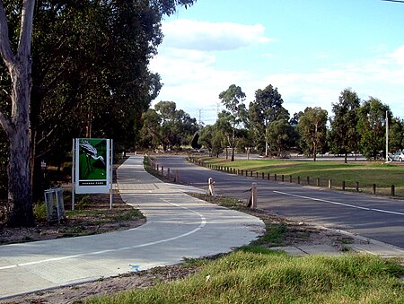
Koomba Park

Koomba Park is one of the parks comprising the Dandenong Valley Parklands in the eastern suburbs of Melbourne, Australia. It consists of 92 hectares (230 acres) of which 33 hectares (82 acres) are publicly accessible, and is bounded by Dandenong Creek, Boronia Road, EastLink, Mountain Highway and Burwood Highway in a clockwise direction. It is managed primarily by VicRoads and Parks Victoria. The park opened in December 1981, and its land was previously used for cattle grazing and apple orchards. The surrounding area is still used for grazing. There are three major power transmission lines running through the park: Rowville-Templestowe Single Circuit Southern (first and second), and Rowville-Ringwood.In 2019, a study found that Koomba Park was one of the least used areas of the Dandenong Valley Parklands, and also garnered the least satisfaction from park users when compared to Jells Park and Tirhatuan Park.
Excerpt from the Wikipedia article Koomba Park (License: CC BY-SA 3.0, Authors, Images).Koomba Park
Dandenong Creek Trail;EastLink Trail, Melbourne Wantirna
Geographical coordinates (GPS) Address Nearby Places Show on map
Geographical coordinates (GPS)
| Latitude | Longitude |
|---|---|
| N -37.8525 ° | E 145.2119 ° |
Address
Dandenong Creek Trail;EastLink Trail
Dandenong Creek Trail;EastLink Trail
3152 Melbourne, Wantirna
Victoria, Australia
Open on Google Maps


