place

Sharpham

Grade II* listed buildings in Mendip DistrictSomerset LevelsUse British English from October 2012Villages in Mendip District
Sharpham
Sharpham

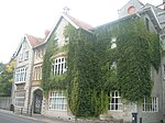
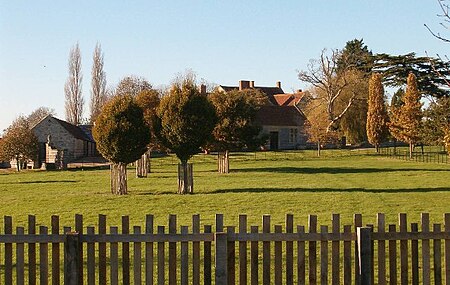
Sharpham is a village and civil parish on the Somerset Levels near Street and Glastonbury in the Mendip district of Somerset, England. It is located near the River Brue.

Excerpt from the Wikipedia article Sharpham (License: CC BY-SA 3.0, Authors, Images).

Sharpham
Sharpham Drove,

Geographical coordinates (GPS) Address Nearby Places
placeShow on map

Wikipedia: SharphamContinue reading on Wikipedia

Geographical coordinates (GPS)

Latitude Longitude
N 51.1356 ° E -2.7653 °
placeShow on map

Address

Sharpham Drove

Sharpham Drove
BA16 9RL , Sharpham
England, United Kingdom
mapOpen on Google Maps

Sharpham
Sharpham
Share experience

Nearby Places

Ham Wall
Ham Wall

Ham Wall is an English wetland National Nature Reserve (NNR) 4 kilometres (2.5 mi) west of Glastonbury on the Somerset Levels. It is managed by the Royal Society for the Protection of Birds (RSPB). Since the last Ice Age, decomposing plants in the marshes of the Brue valley in Somerset have accumulated as deep layers of peat that were commercially exploited on a large scale in the twentieth century. Consumer demand eventually declined, and in 1994 the landowners, Fisons, gave their old workings to what is now Natural England, who passed the management of the 260 hectares (640 acres) Ham Wall section to the RSPB. The Ham Wall reserve was constructed originally to provide reed bed habitat for the Eurasian bittern, which at the time was at a very low population level in the UK. The site is divided into several sections with independently controllable water levels, and machinery and cattle are used to maintain the quality of the reed beds. There are important breeding populations of wetland birds including the rare little bittern and great white egret, and the area hosts several other uncommon animals and plants. The RSPB works with other organisations as part of the Avalon Marshes Partnership to coordinate conservation issues across the Somerset Levels. The reserve is open year-round, and has nature trails, hides and viewing points. It lies within the Somerset Levels NNR and the Somerset Levels and Moors' Ramsar and Special Area of Conservation site. Potential future threats may result from increasing unpredictability in the UK climate, leading to heavy summer rains and extensive flooding. Sea level rise will make the drainage of the Levels more difficult, and current water pumping facilities may become inadequate.

The Shoe Museum
The Shoe Museum

The Shoe Museum in Street, Somerset, England exhibited shoes dating from the Roman era to the present day. The museum closed on 27 September 2019.It showed the history of the Clark family and their company C. & J. Clark and its connection with the development of shoemaking in the town. The Clarks started making slippers, shoes and boots in the town in the 1820s and the company grew, introducing mechanised processes in the 1860s. Production continued until after 2000 when it was moved off-shore, using third party factories, predominantly located in Asia. In the 19th century, in line with the family’s Quaker values, the capital was also extended beyond the factory to benefit social initiatives in Street: a school was founded so that young men and women could combine working in the factory with continuing their education, a theatre was opened, a library was built, along with an open-air swimming pool, known as Greenbank, and town hall. The company still has its headquarters in Street, behind a frontage which includes the clock tower and water tower, In 1993 the redundant factory buildings were converted to form Clarks Village.The museum started in 1951, but was expanded in 1974.It had examples of shoes from the 200 years of the companies history. The museum also included a display of machinery used in footwear production, and a selection of shop display showcards from the 1930s, 1950s and 1960s, and television advertisements.The museum closed to the public on 27 September 2019, and its artefacts will be transferred to the nearby Alfred Gillett Trust.
Street, Somerset
Street, Somerset

Street is a large village and civil parish in Somerset, England, with a population of 11,805 in 2011. On a dry spot in the Somerset Levels, at the end of the Polden Hills, it is two miles (three kilometres) southwest of Glastonbury. There is evidence of Roman occupation. Much of the history of the village is dominated by Glastonbury Abbey, and a 12th-century causeway from Glastonbury built to transport local Blue Lias stone to it. The Society of Friends was established there by the mid-17th century. One Quaker family, the Clarks, started a business in sheepskin rugs, woollen slippers and, later, boots and shoes. This became C&J Clark which still has its headquarters in Street. In 1993, redundant factory buildings were converted to form Clarks Village, the first purpose-built factory outlet in the United Kingdom. The Shoe Museum provides information about the history of Clarks and footwear manufacture in general. The Clark family's former mansion and its estate at the edge of the village are now owned by Millfield School, an independent co-educational boarding school. Street is also home to Crispin School and Strode College. To the north of Street is the River Brue, which marks the boundary with Glastonbury. South of Street are the Walton and Ivythorn Hills and East Polden Grasslands biological Sites of Special Scientific Interest. Strode Theatre provides a venue for films, exhibitions and live performances. The Anglican Parish Church of The Holy Trinity dates from the 14th century and has been designated by English Heritage as a Grade I listed building.