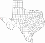
Angel's Triangle, El Paso, Texas

Angel's Triangle (formerly Devil's Triangle) is a neighborhood located in Northeast El Paso in El Paso, Texas. It lies within a right triangle bordered by Dyer Street on the east, the Patriot Freeway (U.S. Route 54) on the west, and Hondo Pass Avenue on the north. Dominated by apartment complexes and older duplexes or single-family homes with a high poverty rate among its residents, and once notorious for crime, drug trafficking and prostitution, it was known as the Devil's Triangle before being officially renamed at a meeting of its residents in the 1990s. and is still sometimes referred to as such, or as the Triangle. The neighborhood's commercial portion is along its eastern and northern edges, on Dyer and on Hondo Pass, respectively; there is almost no business development along Gateway North Boulevard at the western edge of the Angel's Triangle.
Excerpt from the Wikipedia article Angel's Triangle, El Paso, Texas (License: CC BY-SA 3.0, Authors, Images).Angel's Triangle, El Paso, Texas
Norton Street, El Paso Angel's Triangle
Geographical coordinates (GPS) Address Nearby Places Show on map
 Continue reading on Wikipedia
 Geographical coordinates (GPS)
| Latitude | Longitude |
|---|---|
| N 31.864 ° | E -106.436 ° |
Address
Norton Street 8873
79904 El Paso, Angel's Triangle
Texas, United States
Open on Google Maps