place

Lancaster Canal Tramroad

Bridges across the River RibbleHistoric transport in LancashireHorse-drawn railwaysLancaster CanalRailway lines closed in 1879
Railway lines opened in 1803South RibbleTransport in PrestonUse British English from May 2013
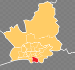
Lancaster Canal Tramroad map

The Lancaster Canal Tramroad, also known as the Walton Summit Tramway or the Old Tram Road, was a British plateway, completed in 1803, to link the north and south ends of the Lancaster Canal across the Ribble valley (Barritt, 2000), pending completion of the canal. The canal link was never constructed.

Excerpt from the Wikipedia article Lancaster Canal Tramroad (License: CC BY-SA 3.0, Authors, Images).

Lancaster Canal Tramroad
Old Tram Road, South Ribble

Geographical coordinates (GPS) Address Nearby Places
placeShow on map

Wikipedia: Lancaster Canal TramroadContinue reading on Wikipedia

Geographical coordinates (GPS)

Latitude Longitude
N 53.7505 ° E -2.6964 °
placeShow on map

Address

Old Tram Road

Old Tram Road
PR1 9TY South Ribble
England, United Kingdom
mapOpen on Google Maps

Lancaster Canal Tramroad map
Share experience

Nearby Places

Winckley Square
Winckley Square

Winckley Square is situated near the centre of Preston, Lancashire, England, at the west end of Avenham. The history of Winckley Square has been documented by Marian Roberts.The square was first established in 1801, around Town End Field owned by Thomas Winckley, as an exclusive residential area for the town's gentry. It is now occupied mostly by insurance, legal and other business offices, although some residential developments have recently been made. The square's gardens, now an open public park, originally consisted of private plots, each owned by a resident. A statue of Sir Robert Peel stands on one side of the central gardens opposite Cross Street, erected by public subscription in 1852.An Italian-style villa was built in 1850 on the south corner of Cross Street (number 11), which was later used as a County Court office from the 1940s. It was demolished in 1969. On the opposite corner (number 10) was the Winckley Club, a gentlemen's club, and next to it, in Cross Street, the Literary and Philosophical Institution (later called Dr Shepherd's Library and Museum), both built in 1846 and both now demolished. The suffragette Edith Rigby lived at number 28. Winckley Street lies between Winckley Square and Preston's main street of Fishergate. Today it is home to mainly professional and religious service providers, including solicitors practices, a translation company, a Jesuit presbytery (taking up the majority of the northern buildings adjacent to St Wilfrids Church) as well as restaurants.