Warabrook, New South Wales
Newcastle, New South Wales geography stubsSuburbs of Newcastle, New South WalesUse Australian English from August 2019
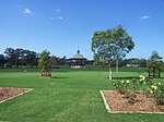
Warabrook is a north-western suburb of Newcastle, New South Wales, Australia, located 8 kilometres (5 mi) from Newcastle's central business district. It is part of the City of Newcastle local government area. The suburb is primarily residential but also includes a shopping centre, an aged care facility and a light industrial area. Warabrook was originally a small agricultural base which had a cattleyard and abattoir. Warabrook has the Eucalyptus Circuit Reserve which has a cycle way and children's play equipment.
Excerpt from the Wikipedia article Warabrook, New South Wales (License: CC BY-SA 3.0, Authors).Warabrook, New South Wales
Olearia Crescent, Newcastle Warabrook
Geographical coordinates (GPS) Address Nearby Places Show on map
Geographical coordinates (GPS)
| Latitude | Longitude |
|---|---|
| N -32.881666666667 ° | E 151.71777777778 ° |
Address
Olearia Crescent
Olearia Crescent
2304 Newcastle, Warabrook
New South Wales, Australia
Open on Google Maps


