Col du Fréjus
France–Italy border crossingsLandforms of SavoieMetropolitan City of TurinMountain passes of Auvergne-Rhône-AlpesMountain passes of Piedmont ... and 4 more
Mountain passes of the AlpsPiedmont geography stubsSavoie geography stubsTransport in Auvergne-Rhône-Alpes

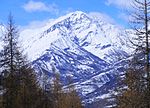
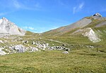
Col du Fréjus (el. 2,542 metres) is a mountain col path in the Cottian Alps on the border between France and Italy. It connects Bardonecchia, Italy to Modane, France. The path over the mountain pass is unpaved and limited to walking traffic. Vehicular traffic utilizes either the toll Fréjus Road Tunnel or the nearby Col du Mont Cenis.
Excerpt from the Wikipedia article Col du Fréjus (License: CC BY-SA 3.0, Authors, Images).Col du Fréjus
Fréjus Road Tunnel,
Geographical coordinates (GPS) Address Nearby Places Show on map
Geographical coordinates (GPS)
| Latitude | Longitude |
|---|---|
| N 45.1306 ° | E 6.6742 ° |
Address
Fréjus Road Tunnel
10052
Piedmont, Italy
Open on Google Maps


