place

East Devon AONB

1963 establishments in EnglandAreas of Outstanding Natural Beauty in EnglandDevon geography stubsEast Devon DistrictEnvironment of Devon
Organisations based in DevonProtected areas established in 1963Protected areas of Devon
Snow05 009
Snow05 009

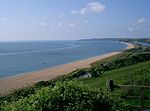
East Devon Area of Outstanding Natural Beauty (AONB) covers over 100 square miles (260 km2) of the East Devon countryside (England). This countryside includes eighteen miles (29 km) of Heritage coastline. The designated area covers: twenty-nine parishes and borders the coastal towns of Exmouth, Seaton and Sidmouth but includes the entire resort of Budleigh Salterton. East Devon has two AONBs within its catchment area which includes the Blackdown Hills (designated 1991) and East Devon AONB (designated 1963), both AONBs make up over 66% of the district. East Devon AONB Partnership is a joint initiative funded by Defra (Department for Environment, Food and Rural Affairs), East Devon District Council and Devon County Council. Through ventures such as community projects and project grants East Devon AONB Partnership helps to conserve and manage the East Devon AONB.

Excerpt from the Wikipedia article East Devon AONB (License: CC BY-SA 3.0, Authors, Images).

East Devon AONB
South Hams Aveton Gifford

Geographical coordinates (GPS) Address Nearby Places
placeShow on map

Wikipedia: East Devon AONBContinue reading on Wikipedia

Geographical coordinates (GPS)

Latitude Longitude
N 50.314 ° E -3.825 °
placeShow on map

Address


TQ7 4FB South Hams, Aveton Gifford
England, United Kingdom
mapOpen on Google Maps

Snow05 009
Snow05 009
Share experience

Nearby Places

South Devon AONB
South Devon AONB

The South Devon Area of Outstanding Natural Beauty (AONB) covers 337 square kilometres, including much of the South Hams area of Devon and the rugged coastline from Jennycliff Bay to Elberry Cove near Brixham. The purpose of an Area of Outstanding Natural Beauty is to conserve and enhance the area's natural beauty. In South Devon this includes: undeveloped coastline, estuaries, geological and geomorphological features, expansive panoramic views, ancient agricultural field pattern, Devon banks, areas of high tranquility, dark night skies and natural nightscapes, historic features, green lanes, well known cultural associations, picturesque villages and hamlets. South Devon AONB was formally designated in August 1960 under the National Parks and Access to the Countryside Act 1949 (South Devon AONB Management Plan 2009-14). The highest point in the AONB is Blackdown Camp at 199 metres above sea level. Towns and villages within the area include Bigbury/Burgh Island, Kingsbridge, Newton Ferrers, Battisborough Cross, Salcombe on the Kingsbridge Estuary, Slapton, Wembury, and Dartmouth and Kingswear on either side of the River Dart Estuary. The AONB also includes several Sites of Special Scientific Interest, including two national nature reserves and four Special Areas of Conservation. It contains nationally important populations of greater horseshoe bat, cirl bunting, shore dock and great green bush cricket. The AONB also includes a 97km section of the South West Coast Path, 10 kilometres of cliffs at Bolt Head, Bolberry Down which is one of the longest stretches of coast belonging to the National Trust and Prawle Point, the southernmost point in Devon.