place

Yarrowbury

Devon building and structure stubsHill forts in DevonUnited Kingdom archaeology stubs

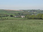
Yarrowbury is an Iron Age hill fort situated close to Bigbury in Devon, England. The fort is situated on Hilltop to the north east of the village at approximately 80 metres above sea level, overlooking the Avon Estuary.

Excerpt from the Wikipedia article Yarrowbury (License: CC BY-SA 3.0, Authors).

Yarrowbury
South Hams Bigbury

Geographical coordinates (GPS) Address Nearby Places
placeShow on map

Wikipedia: YarrowburyContinue reading on Wikipedia

Geographical coordinates (GPS)

Latitude Longitude
N 50.31 ° E -3.862 °
placeShow on map

Address


TQ7 4AN South Hams, Bigbury
England, United Kingdom
mapOpen on Google Maps

Share experience

Nearby Places

South Devon AONB
South Devon AONB

The South Devon Area of Outstanding Natural Beauty (AONB) covers 337 square kilometres, including much of the South Hams area of Devon and the rugged coastline from Jennycliff Bay to Elberry Cove near Brixham. The purpose of an Area of Outstanding Natural Beauty is to conserve and enhance the area's natural beauty. In South Devon this includes: undeveloped coastline, estuaries, geological and geomorphological features, expansive panoramic views, ancient agricultural field pattern, Devon banks, areas of high tranquility, dark night skies and natural nightscapes, historic features, green lanes, well known cultural associations, picturesque villages and hamlets. South Devon AONB was formally designated in August 1960 under the National Parks and Access to the Countryside Act 1949 (South Devon AONB Management Plan 2009-14). The highest point in the AONB is Blackdown Camp at 199 metres above sea level. Towns and villages within the area include Bigbury/Burgh Island, Kingsbridge, Newton Ferrers, Battisborough Cross, Salcombe on the Kingsbridge Estuary, Slapton, Wembury, and Dartmouth and Kingswear on either side of the River Dart Estuary. The AONB also includes several Sites of Special Scientific Interest, including two national nature reserves and four Special Areas of Conservation. It contains nationally important populations of greater horseshoe bat, cirl bunting, shore dock and great green bush cricket. The AONB also includes a 97km section of the South West Coast Path, 10 kilometres of cliffs at Bolt Head, Bolberry Down which is one of the longest stretches of coast belonging to the National Trust and Prawle Point, the southernmost point in Devon.

Challaborough
Challaborough

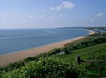
Challaborough is a village and popular surfing beach in the District of South Hams on the south coast of Devon, England. The village is in the parish of Ringmore, though the eastern part of the small bay and beach lies in Bigbury parish. The beach is popular with surfers from Plymouth and the surrounding area because of its powerful waves. Challaborough village consists of two small static caravan sites (one of which is owned by Parkdean Resorts) and a few private houses. Most properties have views of Burgh Island and Bigbury Bay. The beach is popular with surfers and holidaymakers. It is a horseshoe shaped bay with a sand bar protecting the entrance. The beach is divided by a small stream that runs from the valley down into the sea that forms the boundary between the parishes of Ringmore and Bigbury. For boats there are two slipways. One is privately owned by one of the caravan sites and is better maintained, although rather steep. Members of the public have to pay to use the private slipway, but the public slipway, which is only suitable for smaller boats, is free for all to use. Challaborough is popular with the diving community as there are several wrecks along the nearby coastline. Fishing is also good in the area as well as sailing and cruising. Although Challaborough is part of two civil parishes, Bigbury and Ringmore, and therefore does not have its own council, there is a local action group that aims to protect community interests. There are many footpaths as well as the coastal footpath. To the east is the more developed resort of Bigbury-on-Sea and Burgh Island. In the other direction along the coast are a number of coves, Ayrmer Cove and Westcombe (pronounced Wis-com); although more challenging to walk to are far quieter and picturesque. A little further west is the mouth and estuary of the River Erme. The static caravans at Challaborough are mostly privately owned, but there are some hire fleet caravans. Facilities on the lower site include a nightclub, arcade, swimming pool, bar, shop, launderette and child's play facilities. The upper site generally enjoys better views but has fewer facilities and is situated on a steep hill. Disabled access around the lower site and the beach is usually very good; in the winter the sand sometimes shifts below the level of the disabled beach access. Dogs are banned from the beach during the summer months. RNLI lifeguards patrol most of the year. The surf at Challaborough can be excellent, powerful and well formed, hence the popularity of this venue with surfers from all over South Devon.