Churchdown
Borough of TewkesburyUse British English from March 2015Villages in Gloucestershire

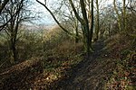
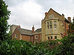
Churchdown is a large village in Gloucestershire, England, situated between Gloucester and Cheltenham in the south of the Tewkesbury Borough. The village has two centres. The older (Brookfield or "village") centre is in Church Road near St Andrew's Church; the more modern centre is in St John's Avenue near St John's Church. Churchdown is a relatively large village, with a population of 11,261 (2001), reducing to 10,990 at the 2011 census. The village has a size of approximately 16.5 km2 (exactly 4,076 acres). Accordingly, the population density is 666 persons/km2.
Excerpt from the Wikipedia article Churchdown (License: CC BY-SA 3.0, Authors, Images).Churchdown
Far Sandfield,
Geographical coordinates (GPS) Address Nearby Places Show on map
Geographical coordinates (GPS)
| Latitude | Longitude |
|---|---|
| N 51.88 ° | E -2.17 ° |
Address
Far Sandfield
Far Sandfield
GL3 2JS , Churchdown
England, United Kingdom
Open on Google Maps


