place

Champneys

Hotel chains in the United KingdomHotel spasHotels in HertfordshireRothschild family residences
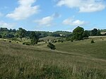
Champneys geograph.org.uk 106742

Champneys is an English country house and its associated estate near Tring, Hertfordshire. The mansion is run as a destination spa by a business using "Champneys" as the brand name for a group of spa resorts and day spas.

Excerpt from the Wikipedia article Champneys (License: CC BY-SA 3.0, Authors, Images).

Champneys
Chesham Road, Dacorum Wigginton

Geographical coordinates (GPS) Address Nearby Places
placeShow on map

Wikipedia: ChampneysContinue reading on Wikipedia

Geographical coordinates (GPS)

Latitude Longitude
N 51.77106 ° E -0.63436 °
placeShow on map

Address

Chesham Road

Chesham Road
HP23 6HX Dacorum, Wigginton
England, United Kingdom
mapOpen on Google Maps

Champneys geograph.org.uk 106742
Share experience

Nearby Places

Cholesbury Camp
Cholesbury Camp

Cholesbury Camp is a large and well-preserved Iron Age hill fort on the northern edge of the village of Cholesbury in Buckinghamshire, England. It is roughly oval-shaped and covers an area, including ramparts, of 15 acres (6.1 ha), and measures approximately 310 m (1,020 ft) north-east to south-west by 230 m (750 ft) north-west to south-east. The interior is a fairly level plateau which has been in agricultural use since the medieval period. The hill fort is now a scheduled ancient monument. The fort is of the multivallate type, in other words having two or more lines of concentric earthworks. Most examples of such forts were built and used during the British Iron Age period between the 6th century BC and the Roman invasion of Britain in the 1st century AD. The period of Cholesbury Camp's construction is unclear, but it has been suggested that it may lie between the 2nd and 1st centuries BC, during the middle to late Iron Age. It was previously, though erroneously, attributed to the Danes and until the early 20th century was known locally as "The Danish Camp" and incorrectly recorded as such on maps. It has also been suggested that it may have been constructed on the same site as an earlier, Bronze Age defensive structure. The fort is located in the Chiltern Hills at an altitude of over 190 m (620 ft). The porosity of the ground in the area severely limited the availability of surface water, essential for livestock, and therefore precluded year-round settlement adjacent to most of the upland pastures. However, there are two aquifer-fed water sources: Holy (or Holly) and Bury Ponds. The constancy of this supply, over many hundreds of years, is cited as being crucial to the decision as to where to site the hill fort and for the early establishment of the isolated community at Cholesbury.

Tring Park
Tring Park

Tring Park is a public open space in Tring, owned by Dacorum Borough Council and managed by the Woodland Trust. It is part of the Chilterns Area of Outstanding Natural Beauty. Half of the 264 acres (107 hectares) is undulating grassland, grazed by cattle. Part of the park, together with the nearby Oddy Hill, is the 35.6-hectare (88-acre) biological "Oddy Hill and Tring Park" Site of Special Scientific Interest (SSSI).The park formerly belonged to Tring Park Mansion, built in 1682 by Christopher Wren and altered externally in the nineteenth century. In the early eighteenth century Charles Bridgeman was employed to lay out the grounds, with a summerhouse and other buildings designed by James Gibbs. The park is Grade II listed by English Heritage in the Register of Historic Parks and Gardens of special historic interest in England.The two areas of the SSSI are grassland on chalk scarp which have a diverse flora including rare species. Much of the parkland is managed by grazing, but ungrazed scrub on sloping areas provides habitat for invertebrates and breeding birds.In the wooded Chiltern escarpment are former carriage rides. One of these, King Charles Ride or the King's Ride, forms part of the Ridgeway National Trail. In 2013 work started to restore King Charles Ride by replanting a circle of lime trees at the 'rond point' and improving the vista over the park and town. In the northeast corner are two Grade II listed monuments: an obelisk known locally as Nell Gwynne's monument, and the summerhouse with a grand four-column temple-style portico.