place

Cholesbury

Former civil parishes in BuckinghamshireHill forts in BuckinghamshireVillages in Buckinghamshire
Cholesbury village hall

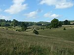
Cholesbury (recorded as Chelwardisbyry in the 13th century) is a village and former civil parish, now in the parish of Cholesbury-cum-St. Leonards, in Buckinghamshire, England, on the border with Hertfordshire. It is situated in the Chiltern Hills, about 4 miles (6.4 km) east of Wendover, 5 mi (8.0 km) north of Chesham and 5 mi (8.0 km) from Berkhamsted. Cholesbury is one of four villages comprising Cholesbury-cum-St Leonards parish. Braziers End is a hamlet which has always been closely associated with Cholesbury. It is a rural community and most local people rely for employment on neighbouring towns, the proximity of London and the availability of broadband technology.

Excerpt from the Wikipedia article Cholesbury (License: CC BY-SA 3.0, Authors, Images).

Cholesbury
Cholesbury Lane,

Geographical coordinates (GPS) Address Nearby Places
placeShow on map

Wikipedia: CholesburyContinue reading on Wikipedia

Geographical coordinates (GPS)

Latitude Longitude
N 51.7546 ° E -0.6521 °
placeShow on map

Address

Cholesbury Lane

Cholesbury Lane
HP23 6ND , Cholesbury-cum-St Leonards (Chesham and Villages Community Board)
England, United Kingdom
mapOpen on Google Maps

Cholesbury village hall
Share experience

Nearby Places

Cholesbury Camp
Cholesbury Camp

Cholesbury Camp is a large and well-preserved Iron Age hill fort on the northern edge of the village of Cholesbury in Buckinghamshire, England. It is roughly oval-shaped and covers an area, including ramparts, of 15 acres (6.1 ha), and measures approximately 310 m (1,020 ft) north-east to south-west by 230 m (750 ft) north-west to south-east. The interior is a fairly level plateau which has been in agricultural use since the medieval period. The hill fort is now a scheduled ancient monument. The fort is of the multivallate type, in other words having two or more lines of concentric earthworks. Most examples of such forts were built and used during the British Iron Age period between the 6th century BC and the Roman invasion of Britain in the 1st century AD. The period of Cholesbury Camp's construction is unclear, but it has been suggested that it may lie between the 2nd and 1st centuries BC, during the middle to late Iron Age. It was previously, though erroneously, attributed to the Danes and until the early 20th century was known locally as "The Danish Camp" and incorrectly recorded as such on maps. It has also been suggested that it may have been constructed on the same site as an earlier, Bronze Age defensive structure. The fort is located in the Chiltern Hills at an altitude of over 190 m (620 ft). The porosity of the ground in the area severely limited the availability of surface water, essential for livestock, and therefore precluded year-round settlement adjacent to most of the upland pastures. However, there are two aquifer-fed water sources: Holy (or Holly) and Bury Ponds. The constancy of this supply, over many hundreds of years, is cited as being crucial to the decision as to where to site the hill fort and for the early establishment of the isolated community at Cholesbury.

Asheridge
Asheridge

Asheridge (recorded Esserugge in the 13th century) is a small hamlet in the parish of Chartridge, in Buckinghamshire, England. Prior to 1898 it was part of Chesham parish. It is situated in the Chiltern Hills, about two and a half miles north west of Chesham, 5 miles from Great Missenden and 6 miles from Wendover. The village name is probably of Old English origin but its meaning is uncertain. It may denote, Eastern or Ash tree Ridge, referring to the situation of the village on the ridge of a hill or could derive from previous associations with the manor of nearby Aston Clinton. Matilda de Esserugge is recorded as having connections with Missenden Abbey in the mid-13th century. Another suggestion is that the name derives from the Old English æsc and hrycg, and meant ‘long hill covered with ash trees.’Asheridge Farmhouse is of 16th-century origin. In 1848 Asheridge is recorded as having a population of 129. A school and congregational church were established there during the latter part of the 19th century and records show they were still in existence in 1891. The Blue Ball public house which was at the centre of the settlement at that time is still in business today.On 5 March 1945 Avro Lancaster PB745 crashed in fields near Asheridge. The seven crew of the aircraft were drawn from the Royal Air Force and the Royal Australian Air Force. There was only one survivor, the rear gunner, William Hart. A memorial service and dedication of a plaque took place on 13 May 2012.Aneurin (Nye) Bevan, Labour Minister responsible for the establishment of the National Health Service and his wife Jennie Lee also a Minister in the same Labour Government and a prime mover in the creation of the Open University, came to live at Asheridge Farm in 1954. After the death of her husband, Nye in 1960 Jennie Lee continued to live there until moving to London in 1968. She became Baroness Lee of Asheridge in 1970.

Hastoe
Hastoe

Hastoe (Halstowe or Halstoe in the 13th century) is a hamlet in the civil parish of Tring. It is located in the Chiltern Hills, 1.7m south of the town of Tring in the county of Hertfordshire and on the county boundary with Buckinghamshire. The highest point in Hertfordshire is 244 m (801 ft) above sea level, this is a quarter-mile (400 m) from Hastoe within Pavis Wood. Running close to Hastoe is Grim's Ditch an Iron Age structure built around 300BC. The section in the Chilterns runs from Bradenham to Pitstone. In the 13th century the manor of Hastoe was conveyed to Ralph le Clerk of Tring by Thomas de Northwode. During the 14th century the lands came into the possession of the Verney family. This resulted in the manor being annexed to the manor of Bunstreux and Richardyns. Hastoe has been closely associated with Tring with parts of Hastoe being incorporated into the Manor of Great Tring in the 17th century. During the 19th century Hastoe became closely associated with the Rothschild family. Nathan Rothschild had begun to rent land and properties in the area as early as 1833, including Hastoe House, a large property in the centre of the hamlet. Nathan's son, Lionel de Rothschild like most of the family was said to be obsessed with hunting and set up his own kennels at Hastoe in 1838. Subsequently, Hastoe being as part of the Tring estate, came into the hands of Lionel de Rothschild acquiring it at auction in 1872. Many of the building of Hastoe were built by the Rothschilds, some following the demolition of earlier properties such as the Hastoe Brewery in 1882. Farm buildings were added to Hastoe, Oakengrove and Longcroft Farms and cottages erected for farm workers. Also built by the family were a chapel, which continued to serve a congregation until 1962, a corn mill, which burned down in 1964, and a distinctive Village Hall known as the Hastoe Room frequented by the Working Man's Club. The Rothschild's estate was sold at auction in October 1938.Richard Llewellyn-Davies (1912–1981) was created Baron Llewelyn-Davies, of Hastoe on 16 January 1964. He was an architect and designer of Milton Keynes. Annie Patricia Llewellyn-Davies (1915–1997) his wife and Labour Party politician, became Baroness Llewelyn-Davies of Hastoe, on 29 August 1967.

Tring Park
Tring Park

Tring Park is a public open space in Tring, owned by Dacorum Borough Council and managed by the Woodland Trust. It is part of the Chilterns Area of Outstanding Natural Beauty. Half of the 264 acres (107 hectares) is undulating grassland, grazed by cattle. Part of the park, together with the nearby Oddy Hill, is the 35.6-hectare (88-acre) biological "Oddy Hill and Tring Park" Site of Special Scientific Interest (SSSI).The park formerly belonged to Tring Park Mansion, built in 1682 by Christopher Wren and altered externally in the nineteenth century. In the early eighteenth century Charles Bridgeman was employed to lay out the grounds, with a summerhouse and other buildings designed by James Gibbs. The park is Grade II listed by English Heritage in the Register of Historic Parks and Gardens of special historic interest in England.The two areas of the SSSI are grassland on chalk scarp which have a diverse flora including rare species. Much of the parkland is managed by grazing, but ungrazed scrub on sloping areas provides habitat for invertebrates and breeding birds.In the wooded Chiltern escarpment are former carriage rides. One of these, King Charles Ride or the King's Ride, forms part of the Ridgeway National Trail. In 2013 work started to restore King Charles Ride by replanting a circle of lime trees at the 'rond point' and improving the vista over the park and town. In the northeast corner are two Grade II listed monuments: an obelisk known locally as Nell Gwynne's monument, and the summerhouse with a grand four-column temple-style portico.