place

Boulby Mine

Laboratories in the United KingdomLoftus, North YorkshireMines in North YorkshireSalt mines in the United KingdomUnderground laboratories
Underground mines in EnglandUse British English from September 2013
Boulby Mine
Boulby Mine

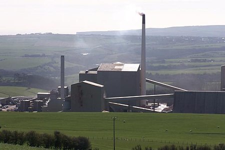
Boulby Mine is a 200-hectare (490-acre) site located just south-east of the village of Boulby, on the north-east coast of the North York Moors in Loftus, North Yorkshire England. It is run by Cleveland Potash Limited, which is now a subsidiary of Israel Chemicals Ltd. (ICL). In early 2016, polyhalite mining commenced. Polyhalite is a natural multi-nutrient fertiliser providing a source of potassium, calcium, magnesium, and sulfur. It is marketed as Polysulphate by ICL and is sold in 3 grades: granular, mini-granular and standard. As well as producing Polysulphate, a granulated blend of potash and Polysulphate is sold as PotashPluS - part of ICL's wider FertiliserPluS product spectrum. It originally produced half of the United Kingdom's output of potash, an agricultural fertiliser. The mined ore consists of 35–45% sylvite ("potash", specifically potassium chloride) and 45–55% halite (rock salt, or sodium chloride). The rock salt is extracted as a by-product and used across the region as a de-icing agent on roads in winter conditions. Other minerals are produced as waste (gangue) to the main effort, but may be sought after by mineral collectors, such as boracite, which occurs just above the beds of potash.

Excerpt from the Wikipedia article Boulby Mine (License: CC BY-SA 3.0, Authors, Images).

Boulby Mine
Whitby Road,

Geographical coordinates (GPS) Address Nearby Places
placeShow on map

Wikipedia: Boulby MineContinue reading on Wikipedia

Geographical coordinates (GPS)

Latitude Longitude
N 54.5534 ° E -0.8245 °
placeShow on map

Address

Whitby Road
TS13 4UJ
England, United Kingdom
mapOpen on Google Maps

Boulby Mine
Boulby Mine
Share experience

Nearby Places

Street House Anglo-Saxon cemetery

The Street House Anglo-Saxon cemetery is an Anglo-Saxon burial ground, dating to the second half of the 7th century AD, that was discovered at Street House Farm near Loftus, in the unitary authority of Redcar and Cleveland, England. Monuments dating back as far as 3300 BC are located in the vicinity of the cemetery, which was discovered after aerial photography revealed the existence of an Iron Age rectangular enclosure. The excavations, carried out between 2005 and 2007, revealed over a hundred graves dating from the 7th century AD and the remains of several buildings. An array of jewellery and other artefacts was found, including the jewels once worn by a young high-status Anglo-Saxon woman who had been buried on a bed and covered by an earth mound. The woman's identity is unknown, but the artefacts and the layout of the cemetery are similar to finds in the east and south-east of England. There are contradictory indications of whether the occupants of the cemetery were Christian or pagan, as signs of both traditions are present. It perhaps represents a fusion of the two traditions during the "Conversion Period" when Christianity was taking hold among the Anglo-Saxons but pagan rituals had not yet been displaced, even among Christians. Archaeologists have suggested that the woman and at least some of the people buried around her may have migrated from the south, where bed burials were more common. They may all have been buried together within the space of a single generation, after which the cemetery was abandoned. The finds were acquired by Kirkleatham Museum, Redcar, in 2009 and have been on display there since 2011.