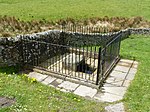
Hollow Brook
Derbyshire geography stubsEngland river stubsEyamHigh Peak, DerbyshireRivers and valleys of the Peak District ... and 3 more
Rivers of DerbyshireTourist attractions in DerbyshireUse British English from September 2024

Jumber Brook is a stream in Eyam in the Derbyshire Peak District. The stream originates to the north of the villiage between Abney and Leam. The brook flows south through the middle of the village before meeting the Dale Brook in Middleton Dale near Stoney Middleton.
Excerpt from the Wikipedia article Hollow Brook (License: CC BY-SA 3.0, Authors, Images).Hollow Brook
Water Lane, Derbyshire Dales
Geographical coordinates (GPS) Address Nearby Places Show on map
Geographical coordinates (GPS)
| Latitude | Longitude |
|---|---|
| N 53.286666666667 ° | E -1.6686111111111 ° |
Address
Water Lane
S32 5RG Derbyshire Dales
England, United Kingdom
Open on Google Maps


