place

St Lawrence's Church, Eyam

13th-century church buildings in England15th-century church buildings in EnglandChurch of England church buildings in DerbyshireEyamGrade II* listed churches in Derbyshire
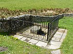
Eyam Church geograph.org.uk 21749

St Lawrence’s Church, Eyam is a Grade II* listed parish church in the Church of England in Eyam, Derbyshire.

Excerpt from the Wikipedia article St Lawrence's Church, Eyam (License: CC BY-SA 3.0, Authors, Images).

St Lawrence's Church, Eyam
New Close, Derbyshire Dales

Geographical coordinates (GPS) Address Nearby Places
placeShow on map

Wikipedia: St Lawrence's Church, EyamContinue reading on Wikipedia

Geographical coordinates (GPS)

Latitude Longitude
N 53.285038888889 ° E -1.678975 °
placeShow on map

Address

New Close

New Close
S32 5RW Derbyshire Dales
England, United Kingdom
mapOpen on Google Maps

Eyam Church geograph.org.uk 21749
Share experience

Nearby Places

Coombs Dale
Coombs Dale

Coombs Dale is a steep-sided, dry carboniferous limestone valley in the Derbyshire Peak District of England. The village of Calver lies about 1 km to the east and the village of Stoney Middleton lies less than 1 km to the north. The dale is cut into the hills on the east side of Longstone Moor. The upper end of the dale is known as Rough Side. Several springs flow down the dale during winter and after heavy rains.The fossil-rich limestone was formed from deposits in a warm shallow sea in the Brigantian stage of the Carboniferous period (around 330 million years ago). Coombs Dale is a designated Site of Special Scientific Interest (SSSI). Ash trees and hazel grow on the scree slopes of the dale sides. Varied shrubs and wild flowers include dogwood, blackthorn, common rock-rose, wild thyme, bloody cranesbill, lily-of-the-valley, mountain melick, woolly thistle, maiden pink, leadwort, cowslip, rare dark-red helleborine and orchids. The local limestone fern Gymnocarpium robertianum thrives on the scree and the rare fingered sedge Carex digitata can be found in places. Grazed native grasses are mainly meadow oat-grass and glaucous sedge. The dale is also habitat for dark green fritillary and brown argus butterflies.Longstone Edge, above the south side of the dale, has been mined for minerals for many centuries. Lead mining heaps and beehive mine shafts are spread across the terrain. Nearby Cavendish Mill has been a processing centre for fluorspar since 1965. Sallet Hole Mine is a 19th-century fluorspar mine in the centre of Coombs Dale, which closed in 1998. There is a disused quarry at the foot of Coombs Dale.Black Harry Gate is at the head of the dale, leading onto Black Harry Lane (an old packhorse route across the moorland). In the early 18th century, a notorious highwayman called Black Harry ambushed and robbed travellers crossing the local moors. He was finally caught by the Castleton constabulary and was hanged, drawn and quartered on the Gallows Tree at nearby Wardlow Mires. There also used to be a Black Harry Farm but it was demolished in the 1970s when the Blakedon Hollow lagoon was built to treat the waste from the fluorspar industry.Coombs Dale is designated as 'Open Access' land for the public, following the Countryside and Rights of Way Act 2000. There is an easy-going footpath along the length of the valley floor. There is access into the dale from both ends, as well as footpaths from Stoney Middleton and Calver into the central section of the valley.Coombs Dale was featured on the TV programme Walks Around Britain in 2016 (season 2 episode 6).

Eyam Moor
Eyam Moor

Eyam Moor is a plateau-topped hill between the villages of Eyam and Hathersage in Derbyshire, in the Peak District of England. The summit of Sir William Hill is 429 metres (1,407 ft) above sea level.It is unclear whom Sir William Hill is named after. Candidates include the four Dukes of Devonshire called Sir William Cavendish, Sir William Saville (Lord of the Manor of Eyam) and Sir William Bagshaw (High Sheriff for Derbyshire in 1805). The radio mast on top of Sir William Hill is a prominent local landmark. Sir William Hill Road is an ancient packhorse route across the moor and was part of the Sheffield to Buxton Turnpike of 1758. The Barrel Inn on Sir William Hill Road at Bretton is the highest pub in Derbyshire. There are three stone circles on Eyam Moor. Wet Withens (known as Eyam Moor 1) is a Bronze Age stone circle at the centre of Eyam Moor with an earthen bank over 30m wide. The prehistoric henge of 10 upright stones (orthostats) is a protected Scheduled Monument. The other embanked stone circle (Eyam Moor 2) on the eastern edge of the moor is also Bronze Age and is about 13m across. Nearby is Eyam Moor 3, a third Bronze Age small circle of 13m diameter with six remaining free-standing stones, without an embankment. Both of these smaller henges are also Scheduled Monuments, as well as numerous prehistoric cairns spread across the moor. Ladywash Mine on the southern edge of Eyam Moor was an old lead mine and was also used to produce fluorspar for the steel industry between 1936 and 1979.Following the Countryside and Rights of Way Act 2000, this gritstone moorland plateau became "Open Access" land for the public. There are footpaths across the moor, leading from roadside car parking on Sir William Hill Road between Eyam and Grindleford.

Middleton Dale
Middleton Dale

Middleton Dale is a steep-sided, carboniferous limestone valley in the Derbyshire Peak District of England. The village of Stoney Middleton lies at the eastern foot of the dale and the village of Eyam lies about 600 metres (660 yd) to the north, through the side valley of Eyam Dale. The dale is cut into the surrounding gritstone uplands of Middleton Moor and Eyam Moor. Dale Brook stream runs down the dale into Stoke Brook and on into the River Derwent 1.5 kilometres (1 mi) beyond Stoney Middleton. The Delf is a secluded, wooded side gorge with a stream between Eyam and Middleton Dale. Opposite The Delf, water gushes from Hawkenedge Well and flows into Dale Brook.The northern side of the valley has an extensive system of caves and sink holes (swallets), although most are narrow and muddy. There are about 70 entrances and more than 3 kilometres (1.9 mi) of cave passages at various levels. The caves have been explored for generations and are often connected to old lead mineshafts. The largest cave system was recorded in 1734 in Dr Short's book History of the Mineral Waters. He wrote how Carlswark Cavern passed right through the mountain and out into Eyam Dale. Inside it there is a large chamber called Oyster Chamber, referring to the abundance of fossilised shells. Merlin Cavern has 1 kilometre (0.62 mi) of passages from old lead mine workings. Fingals Cave is a tall passage with the largest entrance in the dale and is an old mine. Ivy Green Cave is 225 metres (738 ft) long and in 1989 a local boy from Eyam got lost in it and his body was only found a year later.Limestone has been quarried in Middleton Dale for hundreds of years, from Darlton Quarry, Furness Quarry (now known as Horseshoe Quarry) and Goddards Quarry. The fossil-rich limestone was formed from deposits in a warm shallow sea in the Brigantian stage of the Carboniferous period (around 330 million years ago). Middleton Dale has extensive rock climbing, with over 450 graded routes across a series of large buttresses up to 50 metres (160 ft) high. The climbing includes nationally renowned routes such as Alcasan and Our Father. It is a popular location for bouldering.Lovers Leap is a cliff near the foot of the valley, where in 1762 a jilted young lover called Hannah Baddeley threw herself down but survived the fall. The legend is that her long skirt acted like a parachute and then caught in the bushes by a ledge to halt her fall. Whilst she escaped any major injury, she died two years later still a spinster. The old stone pub building at the bottom of the cliff is known as Lovers Leap and is now a restaurant.Stoney Middleton Dale is a designated Site of Special Scientific Interest (SSSI), formerly registered as Shining Cliff SSSI. Ancient woodland of ash trees, wych elm and hazel grows on the lower valley slopes. The trees of the higher limestone crags include rock whitebeam, yew and field maple. The limestone cliffs support a variety of uncommon native grasses. Varied shrubs and wild flowers include dogwood, buckthorn, common rock-rose, dog rose, cowslip, moschatel, wood avens, bluebell, early dog-violet, ramson, golden saxifrage and mossy saxifrage.The A623 road runs along the length of the valley, on an 18th-century turnpike route. There are footpaths into the dale from Eyam but there are no footpaths along the dale, as the road occupies the route.