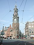
Tolstraat
Streets in Amsterdam

Tolstraat is a street located in the De Pijp neighborhood in Amsterdam. The street runs from Henrick de Keijserplein to Amsteldijk and crosses Van Woustraat approximately halfway. Tolstraat was known as Verversstraat and Ververspad until 1896. It derives its name from a toll gate that was located at its end by the Amstel. After this part of the municipality of Nieuwer-Amstel was annexed by Amsterdam in 1896, the toll gate was relocated, and the street received its current name to avoid confusion with the already existing Verversstraat in Amsterdam.
Excerpt from the Wikipedia article Tolstraat (License: CC BY-SA 3.0, Authors, Images).Tolstraat
Rokin, Amsterdam Centrum
Geographical coordinates (GPS) Address External links Nearby Places Show on map
Geographical coordinates (GPS)
| Latitude | Longitude |
|---|---|
| N 52.368282 ° | E 4.892788 ° |
Address
Rokin
Rokin
1012 LE Amsterdam, Centrum
North Holland, Netherlands
Open on Google Maps


