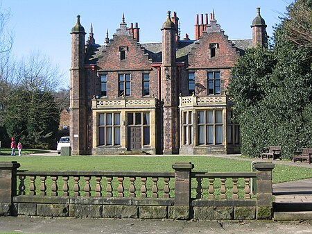
Walton, Cheshire

Walton is a village and civil parish in the Borough of Warrington, Cheshire, England. It is located at the southwest edge of the town of Warrington, next to the parish of Stockton Heath. It is also close to Daresbury and Moore, although these are in the neighbouring borough of Halton. Walton is part of the council ward of Hatton, Stretton and Walton. Walton is divided into Lower Walton and Higher Walton. Higher Walton is south-west of Lower Walton, and is the location of Walton Hall. The estate of Walton Hall and its surrounding gardens, previously owned by the Greenall family, was bought by Warrington Borough Council in 1941 and is now a park with a zoo and municipal golf course.Walton shares its annual church walking day parade with Stockton Heath. The nearest schools are Stockton Heath Primary School and Bridgewater High School.
Excerpt from the Wikipedia article Walton, Cheshire (License: CC BY-SA 3.0, Authors, Images).Walton, Cheshire
Warrington Road,
Geographical coordinates (GPS) Address Phone number Website Nearby Places Show on map
Geographical coordinates (GPS)
| Latitude | Longitude |
|---|---|
| N 53.3555 ° | E -2.6085 ° |
Address
Walton Hall Golf Club
Warrington Road
WA4 5LU , Walton
England, United Kingdom
Open on Google Maps


