place

Winnipeg Walkway

Buildings and structures in WinnipegBuildings and structures in downtown WinnipegCommons link is defined as the pagenameDowntown WinnipegPedways in Canada
SkywaysTransport in WinnipegUnderground cities
Winnipeg Skywalk
Winnipeg Skywalk

The Winnipeg Walkway System, also known as the Winnipeg Skywalk, is a network of pedestrian skyways and tunnels connecting a significant portion of downtown Winnipeg, Manitoba. The City of Winnipeg described the Walkway as a system of 14 skyways and 7 tunnels connecting 38 buildings and allowing for a maximum protected walk of 2 km. The system also provides year-round climate-controlled access to over 170,000 m2 (42 acres) of space, including over 200 shops and businesses, 10 office complexes, 60 restaurants and snack bars, 700 apartment units, 2 hotels, 11 financial centres, and the Winnipeg Millennium Library, bringing together 21,000 employees. The walkway system has expanded since its initial construction.The Walkway is subdivided into four interconnected segments: its skyways chiefly cover Portage, Graham, and St. Mary Avenues; and its underground section includes Winnipeg Square and the underground Portage and Main concourse.It is open every day of the week, typically from 06:30 AM to 12:30 AM, though some individual building hours vary.

Excerpt from the Wikipedia article Winnipeg Walkway (License: CC BY-SA 3.0, Authors, Images).

Winnipeg Walkway
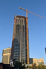
Portage and Main Circus, Winnipeg Downtown

Geographical coordinates (GPS) Address Nearby Places
placeShow on map

Wikipedia: Winnipeg WalkwayContinue reading on Wikipedia

Geographical coordinates (GPS)

Latitude Longitude
N 49.895555555556 ° E -97.138611111111 °
placeShow on map

Address

Portage and Main

Portage and Main Circus
R3X 1V3 Winnipeg, Downtown
Manitoba, Canada
mapOpen on Google Maps

Winnipeg Skywalk
Winnipeg Skywalk
Share experience

Nearby Places

Downtown Winnipeg
Downtown Winnipeg

Downtown Winnipeg is an area of Winnipeg located near the confluence of the Red and Assiniboine rivers. It is the oldest urban area in Winnipeg, and is home to the city's commercial core, city hall, the seat of Manitoba's provincial government, and a number of major attractions and institutions. The City of Winnipeg's official downtown boundaries are: the Canadian Pacific Railway mainline on the north, Gomez Street and the Red River on the east, and the Assiniboine River on the south; the western boundaries of downtown are irregular, following along a number of different streets, back lanes, and across properties. Generally speaking, the western boundaries are rarely further west of Balmoral and Isabel Streets. In 2016, Canadian Geographic produced a map that generalize Winnipeg's downtown boundaries.Neighbourhoods in the downtown area include the Exchange District, Central Park, The Forks, and Chinatown. The downtown area is roughly 3 square kilometres (740 acres). Winnipeg Square, Canada Life Centre, Portage Place, and the flagship store of The Bay (closed 30 November 2020) are all located on the downtown section of Portage Avenue. On Main Street are Winnipeg's City Hall, Union Station, and the Manitoba Centennial Centre, which includes the Manitoba Museum, the Planetarium, the Centennial Concert Hall, and the Winnipeg Railway Museum. Although over 60,000 people work downtown, only 13,470 people actually live in the Downtown area.There are several residential projects under construction on Waterfront Drive and in the Exchange District, and the residential population of the area is projected to increase substantially in the next few years.