Perimilovsky Heights

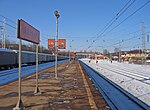
Perimilovsky Heights (Перемиловские высоты) is a place of bloody battles on the eastern front during the World War II from November 27 to December 5, 1941. It was named after the village of Peremilovo, Dmitrovsky District, Moscow Oblast, located on the left (eastern) bank of the Moscow Canal opposite the town of Yakhroma (now the eastern part of Yakhroma), right next to the bridge over the canal. This is one of the frontiers where the Wehrmacht troops were stopped, the easternmost point of their advance on the fronts north of Moscow. At the end of November 1941 Wehrmacht troops approached Dmitrov from the west, from where they shelled the town. A group of enemy tanks broke through to Dmitrov from the direction of Yakhroma, but were defeated by the fire of Soviet army. Due to its steep slopes, extended for 2 kilometres (1.2 mi) along the canal, the height of more than 50 metres (160 ft) above it, it literally overhangs the Yakhroma bridge. Due to its length and steep slopes, the height gives the impression of not one, but several heights, which is why this place is called "Peremilovsky Heights". The opposite, western bank of the channel, is a gentle, long ascent. From this location, the advancing enemy looks like it could fit "in the palm of your hand". It is an object of Russian cultural heritage.
Excerpt from the Wikipedia article Perimilovsky Heights (License: CC BY-SA 3.0, Authors, Images).Perimilovsky Heights
Перемиловская улица,
Geographical coordinates (GPS) Address Nearby Places Show on map
 Continue reading on Wikipedia
 Geographical coordinates (GPS)
| Latitude | Longitude |
|---|---|
| N 56.297777777778 ° | E 37.501111111111 ° |
Address
Монумент героям битвы под Москвой
Перемиловская улица
141840 , Перемилово
Moscow Oblast, Russia
Open on Google Maps