Tehachapi Pass

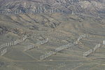
Tehachapi Pass (Kawaiisu: Tihachipia, meaning "hard climb") is a mountain pass crossing the Tehachapi Mountains in Kern County, California. Traditionally, the pass marks the northeast end of the Tehachapis and the south end of the Sierra Nevada range. The route is a principal connector between the San Joaquin Valley and the Mojave Desert. The Native American Kitanemuk people used the pass as a trade route before the American settlement of the region in the 19th century. The main line of the former Southern Pacific Railroad opened though the pass in 1876; the tracks are now owned by the Union Pacific Railroad and shared with BNSF Railway as the Mojave Subdivision. U.S. Route 466 was built in the 1930s, and the road is now State Route 58. The Pass is also the route of the planned California High-Speed Rail line. The Tehachapi Mountains are also crossed by Tejon Pass at the southwest end of the range.
Excerpt from the Wikipedia article Tehachapi Pass (License: CC BY-SA 3.0, Authors, Images).Tehachapi Pass
Pacific Crest National Scenic Trail #2000,
Geographical coordinates (GPS) Address Nearby Places Show on map
Geographical coordinates (GPS)
| Latitude | Longitude |
|---|---|
| N 35.102222222222 ° | E -118.28277777778 ° |
Address
Pacific Crest National Scenic Trail #2000 (Pacific Crest Trail)
Pacific Crest National Scenic Trail #2000
93502
California, United States
Open on Google Maps


