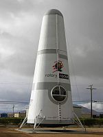
Mojave, California
1876 establishments in CaliforniaCensus-designated places in CaliforniaCensus-designated places in Kern County, CaliforniaMojave, CaliforniaPopulated places established in 1876 ... and 2 more
Populated places in the Mojave DesertUse mdy dates from July 2023

Mojave (formerly Mohave) is an unincorporated community in Kern County, California, United States. Mojave is located 50 miles (80 km) east of Bakersfield, and 100 miles (161 km) north of Los Angeles, at an elevation of 2,762 feet (842 m). The town is located in the western region of the Mojave Desert, below and east of Oak Creek Pass and the Tehachapi Mountains. Mojave is on the Pacific Crest Trail.The population was 4,238 at the 2010 census, up from 3,836 at the 2000 census. Telephone numbers in Mojave follow the format (661) 824-xxxx and the area includes three postal ZIP Codes.
Excerpt from the Wikipedia article Mojave, California (License: CC BY-SA 3.0, Authors, Images).Mojave, California
Sierra Highway,
Geographical coordinates (GPS) Address Website Nearby Places Show on map
Geographical coordinates (GPS)
| Latitude | Longitude |
|---|---|
| N 35.0525 ° | E -118.17388888889 ° |
Address
Carl's Jr.
Sierra Highway 15900
93501
California, United States
Open on Google Maps


