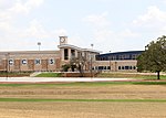
McKinney Roughs Nature Park

McKinney Roughs Nature Park is a 1,140-acre (460 ha) nature park and archaeological site in Cedar Creek, Texas, United States. Located about 13 mi (21 km) east of Austin and next to the Colorado River, the park features 17.6 mi (28.3 km) of trails for hiking, mountain biking, and horseback riding. The park is owned and managed by the Lower Colorado River Authority (LCRA). During the late Archaic Period, around 2,100 years ago, McKinney Roughs served as a camping ground for prehistoric hunter-gatherers. In the 1850s, the land was owned by a ranching family that were early settlers of Texas. Over the years, it passed through various owners until it was acquired by the LCRA, which then transformed it into a nature park in 1998. The park has an unusual convergence of four ecosystems that contribute to its diverse animal and plant life. Within McKinney Roughs and the broader Lost Pines forest, over 250 bird species find habitat, establishing it as a renowned bird-watching destination in Texas. It is also home to several pine trees, mostly notably the loblolly pine, similar to the ones found in the nearby Bastrop State Park and Buescher State Park. Situated adjacent to the 405 acres (164 ha) Hyatt Regency Lost Pines Resort and Spa, McKinney Roughs offers an array of features and amenities. These include an educational science center, a dual zip line, short-term rental facilities for larger groups, kayaking, and guided nature tours, among other offerings.
Excerpt from the Wikipedia article McKinney Roughs Nature Park (License: CC BY-SA 3.0, Authors, Images).McKinney Roughs Nature Park
Hyatt Lost Pines,
Geographical coordinates (GPS) Address Nearby Places Show on map
Geographical coordinates (GPS)
| Latitude | Longitude |
|---|---|
| N 30.145 ° | E -97.46 ° |
Address
Hyatt Lost Pines
Hyatt Lost Pines
78612
Texas, United States
Open on Google Maps


