place

Waitati

German-New Zealand cultureLocalities in the Dunedin City territoryUse New Zealand English from December 2021

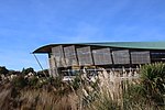
Waitati, from the Māori Waitete, is a small seaside settlement in Otago, New Zealand, within the city limits of Dunedin. It is located close to the tidal mudflats of Blueskin Bay, 19 kilometres north of the Dunedin city centre. The small Waitati River flows through the bay to the sea. The Dunedin–Waitati Highway section of State Highway 1, formerly and colloquially called Dunedin Northern Motorway, ends at Waitati; the highway continues north from here at a slightly lower grade of construction with more frequent intersections and accesses. Three km to the north, the highway ascends the notorious Kilmog hill. The Main South Line railway curves from east to north through Waitati. The old station yard remains as a train crossing loop and parts of the old station building are used by rail maintenance workers. Waitati is home to a branch of the Dunedin Public Libraries, Blueskin Nurseries, a local school, a cafe and general store, and several holiday homes.

Excerpt from the Wikipedia article Waitati (License: CC BY-SA 3.0, Authors).

Waitati
Dunedin-Waitati Road,

Geographical coordinates (GPS) Address Nearby Places
placeShow on map

Wikipedia: WaitatiContinue reading on Wikipedia

Geographical coordinates (GPS)

Latitude Longitude
N -45.75 ° E 170.56666666667 °
placeShow on map

Address

Dunedin-Waitati Road 1516
9016
Otago, New Zealand
mapOpen on Google Maps

Share experience

Nearby Places

The Kilmog

The Kilmog, occasionally called Kilmog Hill and known in Māori as Kirimoko, is a hilly area approximately 20 kilometres north of Dunedin, New Zealand, on State Highway 1, to the north of Blueskin Bay and south of Karitane. Technically more a series of hills than a single hill, it lies between the south branch of the Waikouaiti River and the Pacific Ocean, and reaches its highest point at the 431 m (1436 ft) Hammond Hill, close to the farming community of Merton. A second peak, Porteous Hill, lies at the southern end of the Kilmog, rising to 395 m (1317 ft). The name is better known as that of a steep stretch of State Highway 1, where this main state highway traverses a section of these hills between Waitati and Waikouaiti. In the five kilometre stretch from Evansdale, at the northern end of Blueskin Bay, SH1 climbs from sea level to an altitude of 300 m — the highest point on the highway south of Amberley in north Canterbury. Most of the road is three lanes, with two lanes for uphill traffic on each side of the hill, and a passing lane for southbound traffic on a relatively flat alignment near the summit. The highway is sometimes closed by snow in winter. The area is sparsely inhabited; other than farms around Merton only the coastal stretch is inhabited, with a string of small settlements stretching along the coast from Warrington in the south to Puketeraki in the north, most notably Seacliff. The geology of the Kilmog is predominantly a basaltic intrusion into a raised section of the Otago peneplain, the latter mostly Cretaceous schist, over which is a deposit of sandstone with some quartz. Most of the area is prone to slumping, which leads to regular maintenance for the highway. The instability of the land also led to the disgrace of architect Robert Lawson, whose Seacliff Lunatic Asylum was structurally affected, and to the replacement of a railway tunnel on the South Island Main Trunk line by a cutting. A narrow winding scenic alternative route bypassing the Kilmog follows the coast past the settlements of Warrington and Seacliff, but this is of a relatively poor standard and is not recommended for heavy vehicles. The hill's name, though occasionally disputed, is widely believed to be a corruption of the Southern Māori word kirimoko, kilimoko or kilimogo, the name of a species of mānuka tree used by early Māori for brewing a kind of tea.