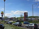
Wombwell Central railway station
1851 establishments in EnglandDisused railway stations in BarnsleyFormer South Yorkshire Railway stationsPages with no open date in Infobox stationRailway stations in Great Britain closed in 1959 ... and 4 more
Railway stations in Great Britain opened in 1851Use British English from December 2016WombwellYorkshire and the Humber railway station stubs

Wombwell Central railway station was a railway station situated on the South Yorkshire Railway company's line between Mexborough and Barnsley. The station lay between Wath Central and Stairfoot. The station was built to serve the mining town of Wombwell, near Barnsley, South Yorkshire, England and is situated on its northern edge.
Excerpt from the Wikipedia article Wombwell Central railway station (License: CC BY-SA 3.0, Authors, Images).Wombwell Central railway station
Park Hill Road,
Geographical coordinates (GPS) Address External links Nearby Places Show on map
Geographical coordinates (GPS)
| Latitude | Longitude |
|---|---|
| N 53.5229 ° | E -1.3932 ° |
Address
Wombwell Central
Park Hill Road
S73 0BE
England, United Kingdom
Open on Google Maps


