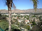
Veterans Memorial Park (Sylmar, California)

The Veterans Memorial Community Regional Park is a large, 97-acre (39 ha), county park in the neighborhood of Sylmar in Los Angeles, California. It is on the foothills of the San Gabriel Mountains at the northeastern edge of the San Fernando Valley. The park includes grassy picnic areas, a large pavilion, camping areas, and a community recreation building.It borders the Angeles National Forest in the north; access is provided to the forest via the May Canyon Road and surrounding hiking trails. There is an 18-hole disc golf course in the south of the park. The park occupies the site of the San Fernando Veterans Administration Hospital built in the 1940s which was severely damaged by the 1971 Sylmar Earthquake. The United States' government transferred ownership of the property to the County of Los Angeles in 1972 and the hospital was demolished. The park was dedicated in 1979.The park has suffered fire damage on multiple occasions due to its proximity to fire-prone mountains. In 1990, a brush fire damaged about 5 acres of the park. On November, 2008, the Sayre Fire started near the park and caused severe fire damage to the park itself, including the destruction of the 2,000-square-foot (190 m2) administration building, a drawbridge gate, water supply equipment and a cactus garden. Access to the park was restricted by fire officials and at first not even park staff were allowed to enter.
Excerpt from the Wikipedia article Veterans Memorial Park (Sylmar, California) (License: CC BY-SA 3.0, Authors, Images).Veterans Memorial Park (Sylmar, California)
Sayre Street, Los Angeles Sylmar Neighborhood Council District
Geographical coordinates (GPS) Address Nearby Places Show on map
Geographical coordinates (GPS)
| Latitude | Longitude |
|---|---|
| N 34.326388888889 ° | E -118.41666666667 ° |
Address
Sayre Street
91340 Los Angeles, Sylmar Neighborhood Council District
California, United States
Open on Google Maps


