place

El Vado

Anza-Borrego Desert State ParkCalifornia Historical LandmarksColonial United States (Spanish)Colorado DesertCommons category link is locally defined
East County (San Diego County)History of San Diego County, California
Anza Borrego Agua Caliente

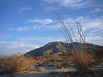
El Vado campsite (transl. the Ford on the Anza Trail) in the Borrego Valley, Borrego Springs, California in San Diego County, is a California Historical Landmark No. 634 listed on March 3, 1958. The El Vado campsite was a desert camp for the Spanish Commander Juan Bautista de Anza and Father Francisco Garcés expedition of 1775 and 1776. The expedition camped for three days and two nights from December 20 to 22, 1775. At the campsite the expedition rested and watered its stock of mules, cattle, and horses. The expedition passed though the Imperial Valley then though the Colorado Desert, now the Anza-Borrego Desert State Park. The expedition's goal was to start Spanish missions in California and presidio forts though Las Californias to the San Francisco Bay. The expedition route is now the Juan Bautista de Anza National Historic Trail. A historical marker is near the campsite in the desert on Horse Camp Road and Borrego Springs Road in Anza-Borrego Desert State Park. The marker was placed there by the California State Parks Commission working with the Kiwanis Club of Borrego Springs.

Excerpt from the Wikipedia article El Vado (License: CC BY-SA 3.0, Authors, Images).

El Vado
Henderson Canyon Road,

Geographical coordinates (GPS) Address Nearby Places
placeShow on map

Wikipedia: El VadoContinue reading on Wikipedia

Geographical coordinates (GPS)

Latitude Longitude
N 33.30168 ° E -116.3843 °
placeShow on map

Address

Henderson Canyon Road 483
92004
California, United States
mapOpen on Google Maps

Anza Borrego Agua Caliente
Share experience

Nearby Places

Borrego Sink
Borrego Sink

San Gregorio campsite at the Borrego Sink in the Borrego Valley, Borrego Springs, California in San Diego County, is a California Historical Landmark No. 673 listed on February 16, 1959. The San Gregorio campsite was a desert camp for the Spanish Commander Juan Bautista de Anza's expedition of 1775 and 1776. The expedition passed through the Imperial Valley then through the Colorado Desert, now the Anza-Borrego Desert State Park. The expedition's goal was to start Spanish missions in California and presidio forts through Las Californias to the San Francisco Bay. The expedition route is now the Juan Bautista de Anza National Historic Trail. At the Anza San Gregorio campsite in the Colorado Desert, the Anza Expeditions stopped and dug deep wells in a dry wash to get water for the expedition and its stock of mules, cattle, and 140 horses. The underground water at Borrego Sink comes when Coyote Creek is flowing, Coyote Creek runs down the valley into Borrego Sink. During rain storms the Borrego Sink can turn in to a swallow lake or a vast mud flat. Coyote Creek is the only reliably perennial creek in Anza-Borrego Desert State Park. Coyote Creek is 18 miles (29 km) long and runs from the city of Anza, California to Borrego Sink. Borrego Sink is at an elevation of 455 feet (138 meters) at the low spot of the Borrego Valley. Coyote Creek supports Desert bighorn sheep and a desert riparian zone. Coyote Creek is divided up into three zones Upper Willows, Middle Willows, and Lower Willows. The Coyote Creek riparian zone supports: narrow-leaf willow (Salix exigua), Fremont cottonwood (Populus fremontii), western sycamore (Platanus racemosa), arrowweed (Tessaria sericea), white alder (Alnus rhombifolia), mulefat (Baccharis glutinosa), honey mesquite (Prosopis glandulosa), and tamarisk (Tamarix ramosissima an invasive species). In a few spots palms (Washingtonia filifera) grow. Coyote Creek riparian zone supports seasonal birds: Bell's vireo, Black-crowned night heron, green-backed heron, common yellowthroat, American kestrel, yellow-breasted chat, black-tailed gnatcatcher, blue grosbeak, downy woodpecker, willow flycatcher, yellow warbler, prairie falcon, red-shouldered hawk, and the black-shouldered kite. The Cahuilla tribe lived along Coyote Creek in the past.A Historical marker is near the campsite in the desert at Borrego Sink, 3 Miles Southeast of Palm Canyon and Peg Leg Roads in Anza-Borrego Desert State Park.

Hot Springs Mountain

Hot Springs Mountain is a peak located in the Peninsular Ranges in California. The mountain rises to an elevation of 6,533 feet (1,991 m) and is the highest point in San Diego County. Some snow falls on the mountain peak during winter. It is located in a remote region of the county, 4 miles from the community of Warner Springs, 12 miles from Borrego Springs, and 50 miles from San Diego. The mountain and its immediate surroundings belong to the Los Coyotes Band of Cahuilla and Cupeno Indians. The summit and fire tower can be hiked via the Sukat Road route from the campground. Hikers and campers must pay an entry fee to access the area.The peak offers views of San Diego, Riverside, San Bernardino, and Imperial counties on a clear day. To the north, Mount San Jacinto and Mount San Gorgonio can be seen, and on a very clear day, Mount Baldy (Mount San Antonio) can be seen too. Toro Peak and San Rosa Mountain are visible due northeast. Looking east, the Anza-Borrego Desert State Park is visible, along with the Salton Sea. Visible to the south is Cuyamaca Peak, the second highest point in San Diego County. On a very clear day, urban San Diego can be seen across the mountains. Finally, to the west, the extreme vastness of the Pacific Ocean is visible, even Catalina Island. The furthest point visible is the Topatopa Mountains of Ventura County over one hundred and fifty miles away. Palomar Mountain is also a point of interest. Tree species found on the mountain peak include Jeffrey Pine, Ponderosa Pine, White Fir, Incense Cedar, and Sugar Pines with their trademark drooping branches. From 2010 through 2012, the mountain and the surrounding land were leased by the tribe to a military training business, Eagle Rock Training Center. The business was evicted in early 2012 at the conclusion of an acrimonious court dispute.