Failand
Use British English from February 2023Villages in North Somerset

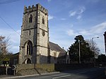
Failand is a village in Somerset, England. It lies within the civil parish of Wraxall and Failand and the unitary authority area of North Somerset. The village has two separate parts. Failand itself is on the B3128 Bristol to Clevedon road, and is the newer and larger part. Lower Failand, a mile away, is the original village (shown as Fayland on old maps). Lower Failand can be reached by single track lanes only. Failand is home to a general store, a pub (The Failand Inn), an observatory, a church and a well used village hall.
Excerpt from the Wikipedia article Failand (License: CC BY-SA 3.0, Authors, Images).Failand
Hill Drive, Bristol Wraxall and Failand
Geographical coordinates (GPS) Address Nearby Places Show on map
Geographical coordinates (GPS)
| Latitude | Longitude |
|---|---|
| N 51.4392 ° | E -2.6905 ° |
Address
Hill Drive 36
BS8 3UX Bristol, Wraxall and Failand
England, United Kingdom
Open on Google Maps


