place

Suncor Energy Fluvarium

1990 establishments in Newfoundland and LabradorMuseums established in 1990Museums in St. John's, Newfoundland and LabradorNatural history museums in Newfoundland and LabradorNature centres in Canada
Science museums in Canada

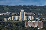
The Suncore Energy Fluvarium, or simply The Fluvarium (meaning 'windows on a stream'), is a public centre for environmental education, located in St. John's, Newfoundland and Labrador, and operated by the Quidi Vidi/Rennie's River Development Foundation. The lowest level of the Fluvarium features an underwater view of Nagle's Hill Brook through nine large viewing windows. Visitors can observe brown trout and salmon living in their natural habitat. The center also has a series of natural water aquariums and terrariums that showcase fish and amphibian species found throughout Newfoundland and Labrador.

Excerpt from the Wikipedia article Suncor Energy Fluvarium (License: CC BY-SA 3.0, Authors).

Suncor Energy Fluvarium
Long Pond Trail, St. John's Pippy Park

Geographical coordinates (GPS) Address Nearby Places
placeShow on map

Wikipedia: Suncor Energy FluvariumContinue reading on Wikipedia

Geographical coordinates (GPS)

Latitude Longitude
N 47.579833333333 ° E -52.732611111111 °
placeShow on map

Address

Long Pond Trail

Long Pond Trail
A1B 4J6 St. John's, Pippy Park
Newfoundland and Labrador, Canada
mapOpen on Google Maps

Share experience

Nearby Places

Pippy Park
Pippy Park

Pippy Park is a 3,400-acre (14 km2) urban park located in the city of St. John's, Newfoundland. The park is a popular camping, hiking and recreational park within the city, and incorporates numerous groomed and wilderness-style hiking/skiing trails, a miniature golf course, a 9-hole and an 18-hole golf course, a driving range, and a public access trailer park with limited tent camping facilities. Trails within the park link to the Grand Concourse walking trails. Pippy Park incorporates the main campus of Memorial University of Newfoundland and the Memorial University of Newfoundland Botanical Garden at Oxen Pond, as well as the Ridge Road campus of the Marine Institute of Memorial University of Newfoundland and the Ridge Road and Prince Philip Drive campuses of the College of the North Atlantic. The park also includes the Confederation Building complex, which houses the Newfoundland and Labrador House of Assembly and numerous offices of the Provincial Government.The park is administered by the C. A. Pippy Park Commission, a Crown Corporation of the Province of Newfoundland and Labrador. The eight members of the commission include representatives of the Provincial Government, the University, the City of St. John's, the Pippy family, and landowners and residents within the park boundaries. Pippy Park is also home to the Fluvarium, an environmental education centre which offers a cross section view of Nagle's Hill Brook. The Fluvarium is not an aquarium in that none of the fish are in captivity - the building offers an underwater view of a natural river. The word Fluvarium comes from the Latin Fluvius (flowing water) and means literally "windows on a stream."

Churchill Park, St. John's

The neighbourhood of Churchill Park in St. John's, Newfoundland and Labrador is located in the city's centre. The neighbourhood is bordered by Freshwater Road to the west, Empire Avenue to the south, Kenna's Hill, Kingsbridge and Torbay Roads to the east and Elizabeth Avenue to the north. Its main east-west thoroughfares are Elizabeth Avenue and Empire Avenue, and its main north-south thoroughfares are Portugal Cove Road and Allandale Road. The neighbourhood borders the campus of Memorial University of Newfoundland to the north, and as a result, it is home to a sizable student population. The area is made up of single-family homes, mostly built in the 1950s and 1960s. The area was the first modern suburb of the city of St. John's, and one of the first residential suburbs in all of Canada, with development plans dating back as early as 1944. Initially, it was planned to be a "garden city," with single-family homes on small cul-de-sacs, generous lots, serviced with nearby parks and trails. Post-Confederation, development of the area changed to include social housing blocks and housing cooperatives, which remain today in the west end of Churchill Park. The architecture and design was planned by Paul Meschino.Churchill Park is home to the Churchill Square shopping centre, which is the area's main commercial centre. Bell Aliant's main switching station for the city is located in Churchill Park. City parks include Kelly's Brook Park, Lions' Park, Larch Place Park and St. Patrick's Park, along with its namesake Churchill Park. Due to its proximity to the university campus, many of the homes in the west end of the neighbourhood (west of Allandale Road) are rented out to students, thus making it the city's principal student ghetto. Its proximity to campus makes renting costs higher than other areas of the city, such as Rabbittown or Georgestown. Houses in the west end of the neighbourhood are mostly small bungalows and social housing projects. The east end is much more affluent, with larger houses and an established and less transient population.