place

Bremen-Verden

1648 establishments in the Holy Roman Empire1648 in the Holy Roman Empire17th century in the Holy Roman Empire1807 in Germany1810 in Germany
1813 in Germany1823 disestablishments in Europe18th century in the Holy Roman EmpireBremen-VerdenDominions of SwedenDuchies of the Holy Roman EmpireEarly Modern history of GermanyFormer monarchies of EuropeStates and territories established in 1648
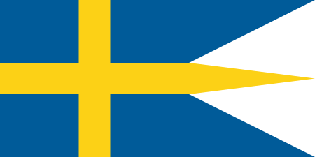
Naval Ensign of Sweden

Bremen-Verden, formally the Duchies of Bremen and Verden (German pronunciation: [ˈfɛɐ̯dən]; German: Herzogtümer Bremen und Verden), were two territories and immediate fiefs of the Holy Roman Empire, which emerged and gained imperial immediacy in 1180. By their original constitution they were prince-bishoprics of the Archdiocese of Bremen and Bishopric of Verden. In 1648, both prince-bishoprics were secularised, meaning that they were transformed into hereditary monarchies by constitution, and from then on both the Duchy of Bremen and the Duchy of Verden were always ruled in personal union, initially by the royal houses of Sweden, the House of Vasa and the House of Palatinate-Zweibrücken, and later by the House of Hanover. With the dissolution of the Holy Roman Empire in 1806, Bremen-Verden's status as fiefs of imperial immediacy became void; as they had been in personal union with the neighbouring Kingdom of Hanover, they were incorporated into that state.

Excerpt from the Wikipedia article Bremen-Verden (License: CC BY-SA 3.0, Authors, Images).

Bremen-Verden
Poststraße,

Geographical coordinates (GPS) Address Nearby Places
placeShow on map

Wikipedia: Bremen-VerdenContinue reading on Wikipedia

Geographical coordinates (GPS)

Latitude Longitude
N 53.600833333333 ° E 9.4763888888889 °
placeShow on map

Address

Poststraße 34
21682 , Schölisch
Lower Saxony, Germany
mapOpen on Google Maps

Naval Ensign of Sweden
Share experience

Nearby Places

Schwinge (Elbe)
Schwinge (Elbe)

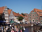
The Schwinge is a river of Lower Saxony, Germany, a left tributary of the Elbe. The Schwinge is 31.8 kilometres (19.8 mi) long. It rises in the Hohes Moor near Mulsum (a part of Kutenholz) on the Stade Geest in the bifurcation area with the Oste. From there it flows in a largely natural, more than 20-kilometre-long (12 mi) upper reach towards Stade. Because of its very natural river scenery and its biodiversity, the floodplains of the upper reach and the meadows near Stade are protected for landscape conservation. In Stade the ca. 1000-year-old Hanse port (Alter Hansehafen Stade) lies at the Schwinge. Here the upper reach is isolated from tides by a sluice called Salztorschleuse since 1792; the lower reach of the Schwinge, which flows into the lower Elbe north-eastern of Stade at Stadersand, begins. Because of the deepening of the Elbe the average tidal hub of the lower reach rose to 3.3 metres (11 ft), because of the backlog when the sluice gates are closed the fluctuations of the upper reach only amounts to a few decimeters. Despite the embankment the banks of the lower reach are lined with exceptional rare fresh water mudflats. The Schwinge is a 4.6-kilometre-long (2.9 mi) federal waterway from the Elbe to the Salztorschleuse. Since the completion of the Schwingesperrwerk, a flood barrier near the mouth of the river in 1971, all places at the Schwinge are protected better against storm surges. The 16-metre-wide (52 ft) gap is closed with two gates. From the Late Middle Ages until the 1950s the Schwinge was used for the transport of goods with smack-like ships called "Ewer". During dredging of the Schwinge and the Hansehafen countless historic artefacts were found, including famous Ulfberht swords from the 8th to 12th century. Today, however, the leisure and sports boat traffic dominates the shipping on the lower reach, the upper reach beyond Stade isn't navigable.