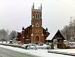
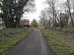
Beacon Way
AC with 0 elementsFootpaths in StaffordshireFootpaths in the West Midlands (county)Geographic coordinate listsLists of coordinates ... and 4 more
Long-distance footpaths in EnglandStaffordshire geography stubsUse British English from March 2017West Midlands (county) geography stubs

The Beacon Way is a long-distance walk of around 40 kilometres (25 mi) through the West Midlands county and Staffordshire, in the Midlands of England. It takes its name from Barr Beacon, a hill to the east of Walsall, and one of the highest points in the West Midlands. The Beacon Way starts at Sandwell Park Farm in Sandwell Valley Country Park and extends as far as Gentleshaw Common where it connects with the Heart of England Way.
Excerpt from the Wikipedia article Beacon Way (License: CC BY-SA 3.0, Authors, Images).Beacon Way
McClean Way,
Geographical coordinates (GPS) Address Nearby Places Show on map
Geographical coordinates (GPS)
| Latitude | Longitude |
|---|---|
| N 52.611 ° | E -1.9682 ° |
Address
McClean Way
McClean Way
WS4 1DG , Heath End
England, United Kingdom
Open on Google Maps


