place

San Ramon Valley High School

1910 establishments in CaliforniaAll pages needing cleanupEducational institutions established in 1910High schools in Contra Costa County, CaliforniaPublic high schools in California
Schools needing cleanup
SRVHS Entrance Stone

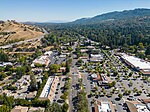
San Ramon Valley High School is a four-year public high school located in the East Bay neighborhood of Danville, California, United States. It is a part of the San Ramon Valley Unified School District. It is a National Blue Ribbon school from the Blue Ribbon Schools Program as well as a California Distinguished School. Its rival is Monte Vista High School.

Excerpt from the Wikipedia article San Ramon Valley High School (License: CC BY-SA 3.0, Authors, Images).

San Ramon Valley High School
Danville Boulevard,

Geographical coordinates (GPS) Address Nearby Places
placeShow on map

Wikipedia: San Ramon Valley High SchoolContinue reading on Wikipedia

Geographical coordinates (GPS)

Latitude Longitude
N 37.8260372 ° E -122.0057941 °
placeShow on map

Address

Gymnasiums

Danville Boulevard
94526
California, United States
mapOpen on Google Maps

SRVHS Entrance Stone
Share experience

Nearby Places

Iron Horse Regional Trail

The Iron Horse Regional Trail is a rail trail for pedestrians, horse riders and bicycles in the East Bay Area in California. This trail is located in inland central Alameda and Contra Costa counties, mostly following a Southern Pacific Railroad right of way established in 1891 and abandoned in 1977. The two counties purchased the right of way at that time, intending to use it as a transportation corridor; the Iron Horse Trail was first established in 1986. In 2003, BART proposed to also use the right-of-way for a DMU line from Walnut Creek station to Tracy via Pleasanton.The trail passes through the cities of Pleasanton, Dublin, San Ramon, Danville, Alamo, Walnut Creek, Pleasant Hill and Concord. When completed, the trail will span from Livermore in central Alameda County to Suisun Bay at the northern edge of Contra Costa County, a distance of over 40 miles (64 km) connecting two counties and nine communities. The trail also directly connects to both the Dublin/Pleasanton and Pleasant Hill BART stations. The trail is maintained by the East Bay Regional Park District. It is a wheelchair accessible paved trail along with adjacent unpaved or soft trails in certain areas.The Iron Horse Regional Trail has several bridges over busy thoroughfares to help improve traffic flow; two notable ones cross over Ygnacio Valley Road in Walnut Creek and Treat Boulevard in Contra Costa Centre. Additional bridges are in the planning process. Despite initial skepticism, and even opposition, the trail is now a major transportation and recreation corridor. One million trips are made each year on the path.