place

Molesey Lock

1815 establishments in EnglandGeography of SurreyLocks on the River ThamesTransport in SurreyUse British English from January 2018
Moleseylock
Moleseylock

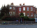
Molesey Lock is a lock on the River Thames in England at East Molesey, Surrey on the right bank. The lock was built by the City of London Corporation in 1815 and was rebuilt by the Thames Conservancy in 1906. It is the second longest on the river at 81.78 m (268 ft 4 in); it is the second lowest of the non-tidal river and third-lowest including Richmond Lock on the Tideway. Upstream of the lock are moorings for small boats, specifically skiff, paddleboard, small speedboat and open kayak hire, a tour boat pier, a kiosk and van parking space for ice cream and soft drinks. A few metres upstream is a combined side weir and front weir followed by an attached ait, Ash Island. A low backwater against the opposite bank which forms the waterside to homes sometimes called the Hampton Riviera continues to a small upper weir. Molesey Lock is within sight of the walls of Hampton Court Palace in southwest London on the opposite bank through the arches of Hampton Court Bridge, designed by Edwin Lutyens (220 m away).

Excerpt from the Wikipedia article Molesey Lock (License: CC BY-SA 3.0, Authors, Images).

Molesey Lock
Barge Walk, Elmbridge

Geographical coordinates (GPS) Address Nearby Places
placeShow on map

Wikipedia: Molesey LockContinue reading on Wikipedia

Geographical coordinates (GPS)

Latitude Longitude
N 51.404722222222 ° E -0.34583333333333 °
placeShow on map

Address

Barge Walk

Barge Walk
KT8 9AJ Elmbridge
England, United Kingdom
mapOpen on Google Maps

Moleseylock
Moleseylock
Share experience

Nearby Places

The Old Court House
The Old Court House

The Old Court House is a Grade II* listed house located off Hampton Court Green in the London Borough of Richmond upon Thames; its origins date back to 1536. The architect Sir Christopher Wren, who lived there from 1708 to 1723, was given a 50-year lease on the property by Queen Anne in lieu of overdue payments for his work on St Paul's Cathedral. The lease passed from Wren's son to his grandson. It was purchased from the Crown Estate in 1984.King Henry VIII obtained the newly built Hampton Court Palace from Cardinal Wolsey in 1526. From that time onwards, all the property around Hampton Court also became the property of the monarch and this included The Old Court House. It is the only house on Hampton Court Green, other than Hampton Court itself, to have a garden that stretches to the River Thames.Wren's dining room is now used as a study. This beautifully proportioned room features wood panelling chosen by Wren and a fine marble fireplace similar to the one he installed for King William III in the King's dining room in Hampton Court Palace. Beyond the reception hall, a flight of stone steps take you into the garden which leads right down to the Thames. In Wren's day his most important visitors – normally royalty – would arrive by river, walk across the garden and up those steps to enter his house via the back door. This meant the garden had to be just as magnificent as the house. The building is accordingly surrounded by several different types of tree and copious bushes bursting with figs, walnuts, apples, crab apples, cherries, raspberries, mint and borage. The greenery extends all the way to the river bank while York stone terraces lead to a pea shingle path which is flanked by lawn. This path then leads to a pond and fountain that was built by Wren and which was listed before The Old Court House itself. Wren's tool house is now a charming garden room from which to enjoy the garden in the summer.

River Mole
River Mole

The River Mole is a tributary of the River Thames in southern England. It rises in West Sussex near Gatwick Airport and flows northwest through Surrey for 80 km (50 miles) to the Thames at Hampton Court Palace. The river gives its name to the Surrey district of Mole Valley. The Mole crosses the North Downs between Dorking and Leatherhead, where it cuts a steep-sided valley, known as the Mole Gap, through the chalk. Much of the catchment area lies on impermeable rock (including Weald Clay and London Clay), meaning that the river level responds rapidly to heavy rainfall.During the second half of the 20th century pollution levels in the river were high; however, since 1995 the water quality has improved dramatically and the Mole now boasts the greatest diversity of fish species of any river in England. Twelve Sites of Special Scientific Interest (SSSIs) that include wetland habitats are located within the Mole catchment area, and the stretch of river through Leatherhead has been designated a Local Nature Reserve. The Mole Gap forms part of a Special Area of Conservation and is an SSSI of European importance.The river has captured the imagination of several authors and poets, particularly since in very hot summers the river channel can become dry between Dorking and Leatherhead, most recently in 2022. In John Speed's 1611 map of Surrey this stretch of the river is denoted by a series of hills accompanied by the legend "The river runneth under". However the river's name is unlikely to have derived from this behaviour: The Oxford Dictionary of English Place Names suggests that Mole either comes from the Latin mola (a mill) or is a back-formation from Molesey (Mul's island). Domesday Book lists twenty mills on the river in 1086, of which Sidlow Mill was the oldest, dating from Saxon times.