Mount Jefferson, Ohio
1838 establishments in OhioNorthwest Ohio geography stubsPopulated places established in 1838Unincorporated communities in OhioUnincorporated communities in Shelby County, Ohio ... and 1 more
Use mdy dates from July 2023

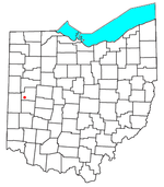
Mount Jefferson is an unincorporated community in Loramie Township, Shelby County, Ohio, United States. It lies along State Route 66 south of Houston. At 958 feet (292 m) above sea level, it is not on a summit, but is located on the south slope of the valley formed by Ninemile Creek, a tributary of Loramie Creek.Mount Jefferson was platted on January 12, 1838, by Jonathan Counts on land owned by Samuel Farnum. Three churches—Christian, Episcopal, and Presbyterian—were organized in the community, but it never grew significantly; only one store and a few houses were ever built in the community.
Excerpt from the Wikipedia article Mount Jefferson, Ohio (License: CC BY-SA 3.0, Authors, Images).Mount Jefferson, Ohio
SR 66,
Geographical coordinates (GPS) Address Nearby Places Show on map
Geographical coordinates (GPS)
| Latitude | Longitude |
|---|---|
| N 40.2425 ° | E -84.333333333333 ° |
Address
SR 66 3023
45333
Ohio, United States
Open on Google Maps


