place

KCOR-CD

1991 establishments in TexasIon Mystery affiliatesLaff (TV network) affiliatesLow-power television stations in TexasSpanish-language television stations in Texas
Television channels and stations established in 1991Television stations in San AntonioUniMás network affiliatesUse mdy dates from July 2023

KCOR-CD (channel 34) is a low-power, Class A television station in San Antonio, Texas, United States. It is a translator of Blanco-licensed UniMás owned-and-operated station KNIC-DT (channel 17) which is owned by TelevisaUnivision; it is also sister to San Antonio–licensed Univision station KWEX-DT (channel 41). KCOR-CD's transmitter is located on César E. Chavéz Bouelvard in downtown San Antonio; its parent station shares studios with KWEX-DT on Network Boulevard on the city's northwest side.

Excerpt from the Wikipedia article KCOR-CD (License: CC BY-SA 3.0, Authors).

KCOR-CD
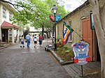
River Walk, San Antonio

Geographical coordinates (GPS) Address Nearby Places
placeShow on map

Wikipedia: KCOR-CDContinue reading on Wikipedia

Geographical coordinates (GPS)

Latitude Longitude
N 29.418333333333 ° E -98.492222222222 °
placeShow on map

Address

River Walk
78205 San Antonio
Texas, United States
mapOpen on Google Maps

Share experience

Nearby Places

La Villita
La Villita

La Villita Historic Arts Village is an art community in downtown San Antonio, Texas, United States. There are art galleries, stores selling souvenirs, gifts, custom jewelry, pottery, and imported Mexican folk art, as well as several restaurants in the district. La Villita connects to the San Antonio River Walk and its outdoor venue, the Arneson River Theatre. It is close to the Alamo, the Henry B. Gonzalez Convention Center, Rivercenter Mall, and HemisFair Park. It is within walking distance of most downtown hotels. Located on the south bank of the San Antonio River, La Villita was one of San Antonio's first neighborhoods. In 1939, as ground broke on the San Antonio River Walk development, city officials led by Mayor Maury Maverick acted to preserve this part of San Antonio's history. It was a Native American settlement and then a collection of primitive brush huts, called jacales, for the Spanish soldiers (and their Indian wives and children) stationed nearby at the Mission San Antonio de Valero (an active mission from about 1718 to 1793, now better known as the Alamo). After a flood in 1819 washed away most of the huts, more substantial adobe houses replaced them. Late in the 19th century, European immigrants from Germany, France, and Italy moved into the area and soon became active in business and trades: retailers, bankers, educators, and craftsmen. The variety of architectural styles seen in La Villita's buildings reflects the cultural mix, from the one-room homes of the poor to the larger houses of the prosperous.La Villita deteriorated into a slum in the early part of the 20th century. During the Great Depression, work began on the River Walk, a make-work project funded by the Works Progress Administration which came close to La Villita. The project, led by Mayor Maury Maverick, sponsored a companion effort in 1939 by the National Youth Administration to restore and preserve this colorful part of San Antonio's history. The NYA offered classes in arts and crafts as part of its program. Today La Villita is an arts community, and is included in the National Register of Historic Places listings in Bexar County, Texas. The galleries and shops found in one city block offer art by local and regional artists featuring oil paintings, sculptures, watercolors, metal art, rock art, textiles, copperwares, pottery, jewelry, stained glass, and regional folk art. During four nights of the Fiesta San Antonio each April, La Villita is host to a Night in Old San Antonio with dozens of booths grouped to offer fifteen areas for various kinds of food, such as Sauerkraut Bend, China Town, Irish Flat, and the Mexican Market. The outdoor festival, with its narrow streets decorated with paper flowers and papel picado (cut paper banners), typically attracts 85,000 celebrants, many wearing costumes and unusual hats. The event is a major fundraiser for the San Antonio Conservation Society.

King William Historic District

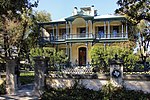
The King William Historic District of San Antonio, Texas was listed on the National Register of Historic Places listings in Bexar County, Texas on January 20, 1972. The area was originally used as farm acreage by the Spanish priests of the Misión San Antonio de Valero, and eventually parceled off for the local indigenous peoples of the area. In addition to residential homes, the district also includes the King William Park and Bandstand originally built in 1892 on the arsenal grounds, and later moved to its current location. Other features are the Upper Mill Park, the King William River Walk, and the Johnson Street pedestrian bridge.The subdividing of the area into residential lots dates to 1853–66, coincided with the German diaspora in Texas. San Antonio by then was experiencing an influx of German immigrants, fueled in part by the German Adelsverein colonization efforts of the mid-19th century. Wilhelm Thielepape was one of those colonists, and served as Mayor of San Antonio 1867–1872. Surveyor Ernst Hermann Altgelt relocated to San Antonio in 1866, and built the first home in the area now known as the King William District. Being the first home builder in the area, he named it after King of Prussia William I, German Emperor. What eventually became a German enclave of the King William Historic District continued into the next generations. The 419 King William house was built in 1884 by Smith Ellis, but eventually sold to Otto Meusebach, the son of John O. Meusebach who led the Adelsverein colonization and founded the German town of Fredericksburg, Texas.The King William Historic District evolved into more of an area for the financially successful, rather than any particular ethnicity. Louis Bergstrom was a successful businessman from Sweden. Several of the homes were designed by British architect Alfred Giles: the Carl Wilhelm August Groos House, the Edward Steves Homestead; Sartor House for jeweler Alexander Sartor Jr. Giles designed the Oge House for business leader and former Texas Ranger Louis Oge. The area was home to the United States Arsenal beginning in 1859. In 1985, the H-E-Butt grocery chain acquired ten acres for their corporation headquarters.

Acequia Madre de Valero (San Antonio)

Acequia Madre de Valero is an 18th-century agricultural irrigation canal built by the Spanish and located in the Bexar County city of San Antonio in the U.S. state of Texas. When Martín de Alarcón founded San Antonio for Spain by establishing San Antonio de Valero Mission in 1718, Franciscan priest Antonio de Olivares and the Payaya people dug Acequia Madre de Valero by hand. It was vital to the missions to be able to divert and control water from the San Antonio River, in order to grow crops and to supply water to the people in the area. This particular acequia was the beginning of a much wider acequia system. Acequia Madre de Valero ran from the area currently known as Brackenridge Park and southward to what is now Hemisfair Plaza and South Alamo Street. Part of it that is not viewable by the public runs beneath the Menger Hotel. The acequia was restored in 1968 and that year was designated a Recorded Texas Historic Landmark.Acequia Madre de Valero was the initial phase of what became a 45-mile acequia network put in place by the Franciscan priests to provide water for the missions and their agricultural endeavors. The location of part of this acequia is adjacent to the Johann and Anna Heidgen House at 121 Star Street, and was a contributing factor in placing the house on the National Register of Historic Places listings in Bexar County, Texas in 2004. The acequia is lined with native limestone, a facet of Spanish engineering techniques. Some of the later stonework in the overall network was added by German immigrants. The full system involved placement of dams, canals and sluice gates. The complete network served residents of San Antonio until late in the 19th century. The Texas Historical Commission placed the historic landmark plaque on a limestone block at the Hemisfair Plaza section of Acequia Madre de Valero.

Tower Life Building
Tower Life Building

The Tower Life Building is a landmark and historic building in Downtown San Antonio, Texas, USA. Construction of the tower began in 1927 and the building rises 404 feet (123 meters) and has 31 floors. The building, which opened in 1929, was originally named the Smith-Young Tower and is the central component of a partially completed development called the Bowen Island Skyscrapers. The eight sided, neo-gothic brick and Ludowici green terra-cotta tower (complete with gargoyles) was designed by noted local architectural firm Ayres & Ayres (Atlee & Robert M. Ayres). While the exterior uses traditional materials such as brick, the internal structure is reinforced concrete on the lower floors, and steel frame on the upper floors. The building also housed San Antonio's first Sears, Roebuck and Company store in its lowest 6 levels.The other completed building in the development is the former Plaza Hotel (also designed by Ayres & Ayres), which opened in 1927. The property became the local outlet of Hilton Hotels in 1956 and was converted into the Granada Apartments in 1966. Subsequent structures in the development were never built as a direct result of the Stock Market Crash of 1929 and the Great Depression. In the 1940s the building was renamed the Transit Tower for the San Antonio Transit Company, which the Smith Brothers purchased in 1943. In 1953 a television transmission tower was added to the structure. Renovations in 2010 removed the obsolete television mast in favor of the tower's original design, a copper tophouse with a 100 ft tall flagpole. The building is now named for its current owner, Tower Life Insurance Company. In 1991 the building was placed on the National Register of Historic Places.