Edwards Heights Historic District
1936 establishments in OklahomaAfrican-American segregation in the United StatesCommons link is the pagenameEthnic enclaves in the United StatesHistoric districts on the National Register of Historic Places in Oklahoma ... and 5 more
NRHP infobox with nocatNational Register of Historic Places in Oklahoma CityNeighborhoods in Oklahoma CityRedliningUse mdy dates from January 2023
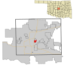
Edwards Heights Historic District is a U.S. historic district and residential neighborhood in Oklahoma City, Oklahoma. It is approximately 4 miles east of downtown Oklahoma City and is roughly bounded by NE. 16th Street, N. Page Avenue, NE. Success Street and N. Bryant Avenue, extension on NE. Grand Boulevard. The Edward Heights Historic District was developed and subdivided specifically for African-Americans; and was founded in the 1930s and 1940s, at a time of racist residential deed restrictions in Oklahoma City.It has been listed as one of the National Register of Historic Places (NRHP) since September 7, 2005.
Excerpt from the Wikipedia article Edwards Heights Historic District (License: CC BY-SA 3.0, Authors).Edwards Heights Historic District
Northeast 19th Street, Oklahoma City
Geographical coordinates (GPS) Address Nearby Places Show on map
 Continue reading on Wikipedia
 Geographical coordinates (GPS)
| Latitude | Longitude |
|---|---|
| N 35.488333 ° | E -97.464444 ° |
Address
Northeast 19th Street 2630
73111 Oklahoma City
Oklahoma, United States
Open on Google Maps