Akron–Canton Airport

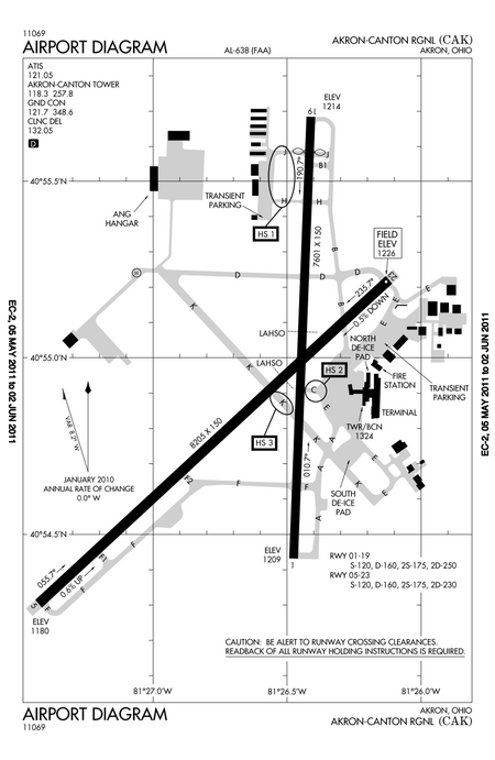
Akron–Canton Airport (IATA: CAK, ICAO: KCAK, FAA LID: CAK) is a commercial airport in the city of Green, in southern Summit County, Ohio (a small piece of each runway is in Stark County), about 10 miles (16 km) southeast of Akron. It is jointly operated by Summit County and Stark County. The airport is a "reliever" airport for Northeast Ohio and markets itself as "A better way to go", emphasizing the ease of travel in comparison to Cleveland Hopkins International Airport. Just under 90% of its traffic is general aviation. It is included in the Federal Aviation Administration (FAA) National Plan of Integrated Airport Systems for 2019–2023, in which it is categorized as a small-hub primary commercial service facility.The 2300-acre (931-hectare) airport has two runways: 01/19 is 7,601 feet long and 05/23 is 8,204 feet long.The airport has a maintenance base for PSA Airlines, a regional carrier that flies under the American Eagle brand for American Airlines.
Excerpt from the Wikipedia article Akron–Canton Airport (License: CC BY-SA 3.0, Authors, Images).Akron–Canton Airport
Lauby Road,
Geographical coordinates (GPS) Address Website External links Nearby Places Show on map
Geographical coordinates (GPS)
| Latitude | Longitude |
|---|---|
| N 40.915 ° | E -81.443666666667 ° |
Address
Akron-Canton Airport
Lauby Road 5400
44720
Ohio, United States
Open on Google Maps


