Kiger Island
Islands of the Willamette RiverLandforms of Benton County, Oregon
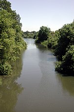
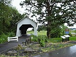
Kiger Island is a 2,200-acre (8.9 km2) island in Oregon formed by a fork between the Willamette River and the Booneville Channel. The island is located at 44°30′45″N 123°14′03″W. Kiger Island is south of Corvallis in southeastern Benton County, with the Linn County line following the contour of the eastern (river) side of the island. The only road to the island, SE Kiger Island Drive, is located off of Highway 99W (SW 3rd Street), just 2.5 miles south of downtown Corvallis.
Excerpt from the Wikipedia article Kiger Island (License: CC BY-SA 3.0, Authors).Kiger Island
Southeast Kiger Island Drive,
Geographical coordinates (GPS) Address Nearby Places Show on map
Geographical coordinates (GPS)
| Latitude | Longitude |
|---|---|
| N 44.5125 ° | E -123.23416666667 ° |
Address
Southeast Kiger Island Drive
Southeast Kiger Island Drive
97333
Oregon, United States
Open on Google Maps


