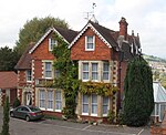
Bathampton Down
Archaeological sites in SomersetBronze Age sites in SomersetCombe DownHill forts in SomersetHistory of Somerset ... and 3 more
Iron Age sites in SomersetNational Trust properties in SomersetScheduled monuments in Bath and North East Somerset

Bathampton Down is a flat limestone plateau in Bathampton, Somerset, England, overlooking the River Avon and the city of Bath. There is evidence of man's activity at the site since the Mesolithic period including Bathampton Camp, an Iron Age hillfort or stock enclosure. It has also been used for quarrying, and part of it is now a golf course.
Excerpt from the Wikipedia article Bathampton Down (License: CC BY-SA 3.0, Authors, Images).Bathampton Down
Golf Course Road,
Geographical coordinates (GPS) Address Phone number Website Nearby Places Show on map
Geographical coordinates (GPS)
| Latitude | Longitude |
|---|---|
| N 51.3847 ° | E -2.3262 ° |
Address
Bath Golf Club
Golf Course Road
BA2 6HT , Grosvenor
England, United Kingdom
Open on Google Maps


